You are using an out of date browser. It may not display this or other websites correctly.
You should upgrade or use an alternative browser.
You should upgrade or use an alternative browser.
History of Pashtuns and related people


[h=4]Origin Of Marwat[/h]Most of the Pashtoons trace their origin from Qais. It is said that he had gone to Mecca where the holy Prophet (PBUH) gave him the name of Abdur Rashid. Due to his piety, decency, wit and wisdom he was widely known and respected in the area [4]. Abdur Rashid (Qais) had three sons. Named Baittan, Ghorghust and Sarban. Baittan was the third. Most of the Pashtuns tribes trace their origin from Sheikh Baittan or Bait Baba.
However, some scholars challenge his theory. Bahadur Shah Zafar Kaka Khel; A renowned historian has discussed in detail various theories in his voluminous book "Pukhtane Da Tareekh Pa Rana kshe" (Pakhtoons in Historical Perspective). Syed Awar-e-Haq Jeelani has translated his work in Urdu under the title of "Pushtun Tareekh Kay Ayeenay Main" (Peshawar, University Book Agency, 1964).
Some theoreticians consider that before the coming down of the Saka tribes of Aryans from the Central Asia, people were already living in the area now called Afghanistan. Those people were skilled in fighting and diplomacy that compelled the invaders to mention them in their epics [5].
[h=4]4.1 Baittan Baba[/h]Baittan baba was a puritan and pious saint of this region. His daughter, named Matto, was married to one Syed Shah Hussain, known as a prince of Persia. In a state of distress, Shah Hussain came to seek the blessing of Baittan Baba. Here, he took to worship and prayers and earned the favour of his mentor. The marriage of Shah Hussain and Matto generated some romantic stories. The oft-repeated story says;
"A Persian prince, Shah Hussain, on account of intense penury and indigence, was driven to the necessity of seeking succour from Bait Baba. He also remained engaged in singing hymns and worship. Finally, he was enamoured of the beautiful tresses of a beautiful maiden, the daughter of the Bait Baba. He fell deeply in love with the Baba's daughter, captivating belle. Bulk of work of piety did not thwart the emotions of love to avoid the scandal of their secret marriage. The first issue of Bibi Matto was named as Ghalzae, the thief son, and the other was named Ibrahim Lodhi". [6]
"One day, Ibrahim brought meal to his grand father, Baittan, who was so pleased that he uttered these words for him "loe-day" (he is a great one). This word later on became on Lodhi." [7]
Shah Hussain had another wife; name Mahi. She was the daughter of Kaaghdoar who was a Karlanee Pashtoon. The offspring of these two (Mahi and Matto) were known as Mathi tribes [8]. Some other scholars believe that the name of the tribes became popular after the name of Bibi Matto.
Shah Hussain, a Persian Prince, was a Syed. Due to the atrocious attitude of the Umayya and Abbasid dynasties, many Syed families immigrated and settled in Persia and Khurasan (other parts of Afghanistan). On account of the defaulting attitude of the rulers towards the Sadat, the puritans kept their identity secret. It is just possible that predecessors of Shah Hussain, although Syed they were, might have arrogated for themselves the status of "Princes' of Persia". But in common parlance, Pukhtuns call a Syed as Bacha or Shahji (king) owing to deference.
Bibi Matto had six sons. Amongst them, Ghalzai and Ibrahim Lodhi became more famous. Genealogical tree (Placed at Annexure A) shows that Ibrahim Lodhi had three sons; each founding a sub tribe after his respective name. Among those sub tribes, the Lohani became more famous. Marwats are descendants of the Lohani sub tribe. They are subdivided into four clans (also known as Khels) known as Salars, Tappay, Mussa and Nuna [9].
Some writers reject this theory and try to malign the pious person of Baittan Baba. Raverty leads the Group that has spared no chance to sling mud on this noble personality. Disparagement of such a pious man in fabulous stories is highly objectionable and does not appeal to the sound mind. The romantic story of Shah Hussain and Bibi Matto is a creative ingenuity. Shah Hussain was allowed to live in the house of Baittan. He won the heart of his host who felt strong desire to give daughter's hand in marriage to him.
The Marwats form one of the four Great sub-tribes of the Lohani tribes and are also known as Speen Lohani (white Lohanis). However, it is evident that the Marwat and the rest of Baittan tribes are the combination of the three best ancestries of Asia. In their veins, flows the Persian, the Israeli and Turkish Blood. The history of the Marwat tribe is old, interesting and revealing. The recent research in the field highlights a fascinating story of this tribe, The Lineage of this tribe goes back to the Pre-Islamic era [10].
Following interpretations have been made in this connection by Dr Chiragh Hussain in his book Dood-e-Chiragh:
- The predecessor or the ancestor of the Marwat was named as Marwat.
- There is a hill in Katwaz. Afghanistan, which is called Marwati. The Marwat tribe formerly inhabited there, and so they were named Marwat.
- The word Marwat is derived from Arabic word "Murrawat", which means compassion, generosity and manliness [11]. This really reflects and interprets the word Marwat on account of their moral values, habits, social contacts and hospitality even to day. In the past, the Aryan Chiefs took oath in the name of the Marwat tribe's modesty, when they were sworn as leaders of their tribe's.
- The modern Western historians are of the view that all these old names are of geographical importance. For instance, Bait is the center of river Dajla and Farrat, and Haroot and Maroot are the names of two tribes. They were famous in the past for their purity. In the ancient religious books they have been mentioned in literary and allegorical sense.[12]
Writers have expressed different views regarding the exodus of this tribe from Katawaz. One version goes as:
"A petty servant of the Sulaiman Khel tribe abducted a woman form the house of Azad Sultan Khel and sought asylum with the Marwat Tribe; who provided asylum to them under their convention (Nanawati). The Sulaiman Khel demanded extradition and handing over of the culprits, which the Marwat declined as they were bound by traditions to protect the honour and life of refugees under their protection. [13]
On refusal of several requests, the Sulaiman Khel were left with no other option but to attack the Marwats with full force. The Marwat were strong enough to withstand and repulse their initial attack. Then the Sulaiman Khel sought the help of other clans of the Ghilzai tribe, who answered the call positively. The combined force of the Ghilzai clans overpowered the Marwat tribe. To avoid the constant threat from the rival clans, the Marwats decided to migrate to some remote parts. Hence their subsequent migration to the Daman Area."[14]
We cannot ignore the fact that permanent settlement in old days was difficult. The whole tribe travelled and settled at places where better grazing grounds were found. Furthermore, as "might is right" goes, tribes with less fighting strength had to leave the place for stronger invaders. The Marwat, being less in number, migrated to safer places; Hence their migration to the Tank area.
Dr. Syed Chiragh Hussain says, "The early history of the Marwat is cloudy due to non availability of proper record like other Pashtoon tribes. However, in 1451 AD when the Delhi Sultanate was captured by Lodhis, then the trace of the Marwat is to be found in his reign.
Bahlol Lodhi's call for getting land (Jagirs) in Hindustan was warmly received here. Khawas Khan Marwat was one of the famous Generals in Sher Shah's reign. He had lost his life during the war of succession won by Salim Shah Suri." [15]
According to an account, the settlement period of the Marwat in the Daman area is probably during the reign of Lodhis. Sir Denzil Ibbitson does not agree to it. In his view the Marwat settled here in the reign of Moghul Emperor Akbar. [16]
However, their stay in the Daman area was not long. They took new feuds on distribution of water with the Raees (Chief) of Tank, Shah Nawaz Khan Katti Khel. The Katti Khels were also their cousins. Marwats came around Tank and were in a position to drive the Katti Khels out of it. However, Shah Nawaz Khan sought help from the Gandapur and Mian Khel families and repulsed the Marwat attack. As a result, they were driven out of Daman and forced to migrate towards the Baeena Pass (Dara Pezu). [17]
Thus for one reason or the other they migrated to Daman and then Pezu via Gomal Pass. "Most of them ultimately settled in Tank with Niazis (also a branch of Lodhi group) who had been in the past driven in the same manner from their original lands". [18]
[h=4]4.3 Arrival Period[/h]Mira Jan Sayal (M.J. Sayal) writes in his book "Da Pukhtano Qabilo Shajare" that, " The Marwat arrived in this area during the early years of the reign of the Mughal King Akbar (1556-1605). They took advantage of the internal dissension among the Niazis, expelled them from this area and settled on the right bank of river Gambilla.
Mayar, a branch of Niazis, sought help from the Marwat against its fellow Niazis Clan, Sarhang. The Marwat attacked the Niazis under Malik Qatal Khan and other Maliks. In a severe battle near Tatti Michan Khel, the Niazis were completely defeated and pushed towards Esa Khel. Among them, only the Michan Khels were spared due to their neutrality and religious position."[19]
With the conquest of such a vast area, the Marwats dropped the idea of taking back Tank form Shah Nawaz Katti Khel, who extended his hand for friendship. This was accepted for the sake of guarding that Frontier. [17]
[h=4]4.4 Occupation of Lakki Marwat[/h]For some time the Marwats confined themselves to pastoral pursuits. When their number increased, groups of families went out of the close settlement and spread over the vast plain - each within rather undefined limits of the allotment of the section to which it belonged. Such groups in turn became centres from which further migration took place. Thus in course of time the whole plain became populated. A large proportion of the Marwat settled down as agriculturists. Each community cultivated and held its land according to the "Wesh Tenure". [20]
During the Mughal period, the Marwats; being little interrupted by others and being strong and united enough to defy any encroachment by other neighbouring tribes, enjoyed the singular good fortune of being left to themselves, and this developed and worked out their ancient communal institutions.
Meanwhile, the Mughal Empire, which was already on decline received a deathblow as its province on the right bank of the Indus River was conquered by Ahmed Shah Durani in 1756. The whole territory of the Marwats came under the Kingdom of Afghanistan. It was ruled by the Durani King for more than 70 years; although practically they remained independent. In fact, this area was not regularly occupied because at that time, the Marwats lived a nomadic life. When attacked from any side they would simply migrated towards the hills with all their goods and cattle. During such visitations the material loss was not great, as those who led nomadic pastoral life retired with their flocks and herds into the hills, and those who tilled the soil either remained with the royal revenue collectors or fled to the hills. Thus beyond a partial destruction of his crops, no Marwat lost much as the stay of the Kabul troops was never long and the burning of his house only gave him an extra trouble of procuring a few ox-loads of reeds from the marsh and twigs from the jungle and building a hut of them.
In the words of Ghulam Habib Afghani, for the Marwats, the capturing of such a vast area was greater than their needs and they did not feel sorry for Tank which they had lost earlier to Shah Hussain [21]. This vastness of land was the reason why there was no internal conflict. But the Niazis and the Ghazni Khel Khattaks from the east, and Kati Khel, Sulaiman Khel Wazir and Mahsoods from the south repeatedly attacked the Marwats. But due to their unity, they succeeded every time to repulse these attacks. They opposed any type of intervention from any tribe till Edward took the whole area under his control for his political objectives. [22]
The Marwats fought almost sixty battles against different tribes for safeguarding their frontiers. Sarfaraz Khan Khattak admits this fact in his book, "Tareekh-e-Khattak".
[h=4]4.5 Disunity and Division[/h][h=4]4.5.1 Gund bazi (tribal jealousy)[/h]Unluckily this unity could not remain for a long time. The Marwats were divided into two gawands (groups) known as Speen-Gund (the white group) and Tor-Gund (the black group). This division among the Marwats is known as Gund Bazi (internal rivalry). The Speen-Gund includes Mama Khel, Begu Khel, Maidad Khel etc, whereas the Tor Gund includes Isa Khel, Ghazni Khel, Adam Zai, Tatter Khel etc.
Initially all Maliks accepted the eldest man as the leader and considered his decision final and followed that. During the conflicts with Ghiljis, Wazirs, Dawars, Masoods, Niazis and Daulat Khels, decisions were taken by the headman and they were obeyed. However, in the wake of Gund Bazi the Marwat clans split into two groups. The leader of each Gund was supported by the allied Maliks. Basically the Gund Bazi started with a conflict between Begu Khels and Isak Khels. Maidad Khels joined the Begu Khel Gund and Ghazni Khel joined the Isak Khel Gund. Meena Khels held an important position due to their occupation of the Lakki City.
The Gund Bazi started when Salar Khan Maidad Khel; being proud of his Maliki (Chieftancy) tried to destabilize the Maliki of Sikandar Khan Azghar Khel with respect to Lakki City. Sikander Khan along with Sadar Khan Isak Khel attacked Salar Khan near village Dalo Khel (presently located on Tajazai-Lakki Highway). Salar Khan, his two brothers and five other men were killed. As a result of this Gul Rang Khan; son of Saleem Khan Miandad Khel became the Malik. He was bold, courageous and dashing and he fought several battles against the Khattaks.
Another Malik who was aspiring to share the Maliki with Gul Rang Khan was Gulan Khan of Tatter Khel. Gul Rang Khan had him killed on the plea that Gulan Khan showed cowardice during the Khattak campaign. When Almar Khan Isak Khel came to Samand Khan Begu Khel, he sided with Gulrang Khan. From that time, the Marwat tribe was divided into two groups.
"Any type of attack on one man was considered an attack on the whole Gund and it was responded to by the whole Gund. The whole Gund became a party to the happiness and sadness of a member of his own Gund". [23]
In the words of Ghulam Habib Afghani, other tribes took great advantage of this disunity because a lot of money and resources were spent on the procurement of weapons. Due to this Gund Bazi, Nawab Hafeez Ahmed Khan of Mankera was invited in 1819 to capture this area and secure taxes. Later on, the Nawab abandoned this area in favour of the Sikhs in 1823. [23]
[h=4]5.0 The People[/h]The district is inhabited by the Marwat tribe. The majority of the Marwats reside in and around Lakki Marwat, which had been a Tehsil of District Bannu for more than 132 years. A small proportion of other tribes also settled here. The main reason is that the area had remained economically un-developed through the ages and had a little attraction for new settlers.
The people of the Marwat tribe are strong, sturdy, and tall, of very sound physique and fair complexion. About the people of this area Sir Herbert says, "the Marwat descend from the pure and nice generation of the trans-Indus area, tall, stout, handsome, candid with rosy cheeks generally. These entire features are due to their pure and nice Afghan origin and probably this is the reason that they are very dignified and generous and meet the strangers with great courtesy, They are very generous towards their woman folk as compared to the other tribes of Pathans". [24]
Like other Pashtoons, Marwats are divided into numerous Khels. The tribe is territorially divided into three great Tappas, viz, Dreplara, Musakhel-cum-Tappi, and Behram (subdivided into minor tappas Umar Khan Khel and Tatezai)
The two branches of Salar, i.e. Khado Khel and Achu Khel, along with Aba Shaheed Khel Sadat family, are known as dreplara. (Children of three parents). According to the distribution of land (Wesh System), Tappa Musa Khel and Noona Khel settled in the western part of Lakki Marwat. Behram in the middle and Dreplara in the eastern part.
Since most of the territory occupied by the Musa Khel (Kot Kashmir, Gandi Khan Khel. Mama Khel, Bayist Khel, Takhti Khel, Bragi, Shatoora), Noona Khel and Tapey is Pakha (solid) area, therefore they are called Pakha Marwat (Solid Marwat). The area occupied by Dreplaree is sandy. Hence they are called Saga Marwat (Sandy Marwat).
Some important Khels are:
- Musa Khel; with sections like the Takhti Khel, Januzai and Passani.
- Achu Khel; with sections like Begukhel, Isak Khel, Ahmed Khel etc.
- Khuda Khel; with sections like Sikander Khel, Mamakhel etc.
- Bahram/Baram; with sections like Umer Khan Khel, Totazai, and with sub section like Tatezai/Tajazai, Dalkhozai, Landiva, Ghazni Khel and Tappi.
[h=4]References:[/h]
- District Census Report of Lakki Marwat, 1998. (Islamabad, Population Census Organization, Statistics Division of Pakistan, August 2000), P.1.
- Shah Sawar Marwat, "Da Marwato Tareekh", unpublished.
- Fazl-ur-Rahim Marwat, (Introduction) Marwat Students Union, University of Peshawar, PP. 10-11.
- Daily: The Mashriq, Peshawar. 14 January 1993.
- Dr Sher Zaman Taizi, Nara Zheba (The Virile Language), (Pabbi, Kamil Pukhto Adabi Jirgah Pabo Seema). P. 11
- Olaf Caroe, The Pathans 1550 BC � 1957, (London, MacMilan, NY, 1958). PP. 11 �12,
Tuffail Ahmad Khan, Bannu Tareekh Kay Ayeenay Main, (Tahi Kulachni Publishers, 1979). PP 116 � 117. - Insaf, Weekly Magazine (Urdu), Peshawar. 11 July 1955.
- Ghulam Habib Afghani, Marwat and native Tribes, Vol II (unpublished)
- Tufail Ahmad Khan Faizi, op cit. PP 424 � 425.
- Gul Ayub Saifi, Bannu Au Da Waziristan Tareekh, (Bannu, Nazir Medical Store, Lakki Gate. 1969), PP. 65 � 69.
- Haim, Haim's One-Volume Persian- English Dictionary. (Tehran, Farhang Moaser, 1983). P 788
- Dr Syed Chiragh Hussain, Dood-e-Chiragh. (DI Khan. Ishrat Art Press. 1980). PP 31-34
Parvez Ahmad Khan, The Bannu Valley, (Pakistan Study Centre, University of Peshawar, 1987) P 53 - Dr Chiragh Hussain. Op. cit. PP 31-35
- Syed Bahadur Shah Zafar Kaka Khel, Pashtun Tareekh Kay Ayeenay Main (Translation from Pashto by Syed Anwarul Haq Jeelani). (Peshawar. University Book Agency. 1964). P. 64
Dr. Syed Chiragh Husain. Op.cit - Interview with Dr. Syed Chiragh Hussain, Peshawar, 22 Jan 2001
- Sir Denzil Ibbitson, Lesser Known Tribes of NWFP; India and Pakistan, Vol 11. (Delhi Ammar Prakshan. 1992) Pp. 71-72
- Dr. Syed Chiragh Hussain. Dood-e-Chiragh. (DI. Khan Ishrat Art Press. 1980). Pp 32-35
Op cit. PP. 32-33 - Dr Syed Chiragh Hussain, Dood-e-Chiragh. (DI.Khan Ishrat Art Press 1980). P. 32.
1998 District Census Report of Lakki Marwat. (Islamabad. Population Census Organisation. August 2000). P. 4. - M.J. Siyal Mohmand, Da Pukhtano Da Qabilo Shajare. (Peshawar. University book Agency, 1986). PP. 111-112.
- Govt of NWFP. Gazetteer of Bannu District (1883-84). (Lahore. Sang-e-Meel. 1989). PP. 19-30.
- Da Marwat and Native Tribes, Op. cit.
- Dr. Syed Chiragh Hussain, Op. cit. p. 33-34
- Gul Ayub Saifi, Marwat Tareekh Pa Ranra Ke, Opo.cit.PP. 140-143
Ghulam Habib Afghani. Op.cit. - Dr Fazl-ur-Rahim Marwat. Ta'ruf (Urdu) to Marwat Students Union. (Peshawar, University of Peshawar, 1982). P. 8
- Gazetteer. Op. cit. also Sir Hezbert.
Last edited:

Kandahar of the Arab Conquest
S. W. Helms
World Archaeology, Vol. 14, No.3, Islamic Archaeology (Feb., 1983), 342-354.
Old Kandahar is a large, impressive ruin field near Afghanistan's modern 'second' city, bearing the same name. For years the site has been central to many arguments about the most ancient geography and history of the region. It has been identified with an Alexandria/ Alexandropolis, referring to the conquest of Alexander the Great.
For the Islamic period the excavations on behalf of the Society for Afghan Studies have revealed some striking new evidence, particularly for the period of the Arab Conquest during the later 7th and early 8th century. This paper outlines some of these emerging new arguments and suggests some tentative additions to the long story of the toponymy of Central Asian cities.
I
Much of the early Islamic history of the eastern regions - as-Sind is shrouded in mystery and described in legends. An account, for example, quoted by Ferrier (1857), may be taken as an apocryphal reference to the fortunes of the Arab conquerors of Old Kandahar:
In the year of the Hegira 304 (AD 916), in the Caliphat of Moktader, in digging for the foundation of a tower at Kandahar, a subterranean cave was discovered, in which were a thousand Arab heads, all attached to the same chain, which had evidently remained in good preservation since the year Hegira 70 (AD 689) for a paper with this date upon it was found attached by a silken thread to the ears of the twenty-nine most important skulls, with their proper names.
Similarly, the only certain account of the Arab conquest of al-Qunduhar, which must be Old Kandahar, comes from al-Baladhuri (futuh al-buldan) who died in AD 892, mentally deranged after drinking the juice of the anacardia (baladhur), hence his name. This is quoted as an etiological legend (Enyclopaedia of Islam, 2nd ed.). According to al-Baladhuri the general 'Abbad ibn Ziyad raided the frontier of aI-Hind from Sijistan (Seistan) in the time of the Umayyad Caliph Mu'awiya' (AD 661-80) 'as far as the river Hindmand' (Murgotten 1924: 212) which probably refers to the Hilmand (the Erymandus of Pliny VI, 61,92; the Haetumant and so on). Ziyad 'crossed the desert until he came to al-Kunduhar' (Murgotten 1924: 212), travelling eastwards from 'Kish' (cf. al-Istakhri and ibn Hauqal below) across the semi-arid land between the Khash-rud and the Hilmand/ Arghandab confluence about the region of Bost.
AI-Qunduhar of Baladhuri is the earliest mentioned name that our city was to bear for most of its consequent Islamic history. Etymologically there is a problem here that is relevant throughout the city's most ancient history: that much can be read into a name, and nothing. In Murgotten's translation, 'Abbad ibn Ziyad saw at al-Qunduhar 'the high turbans of the natives, and had some made like them. [In consequence of this] they are called 'abbadiyah.' Yet the Arabic has been read in another way: that the city was renamed 'Abbadiya, after its conqueror (Rawlinson 1849:127; 1873:213; Rescher 1917-23; cf. at-Tabba 1959: 210).
Whether the city was renamed or merely continued as al-Qunduhar famed for its tall turbans, all that we can glean from this and other accounts of the Conquest is that the city did not then feature as an important centre. Bost, Herat, Ghazni and Kabul among others still known today are listed, but with the exception of Baladhuri, never al-Qunduhar. That name does not reappear until the Ghaznavid period and then only in poetry, some of which was written specifically for those Seljuk rulers during the early 11th and late 12th centuries (Wallbrecht in Fischer et al. 1976: 295ff.).

Figure 1: South-central Afghanistan. Click to Enlarge.
Still on the etymological side of the problem: how far back in the city's history can one take its name? The allegation that Kandahar (Pushtu) or Qandahar (Arabic and Farsi) comes somehow from Alexander the Great (via Iskandarabad for example) has been long rejected. That somehow one can make Kandahar out of
 (Helms 1982) may be possible, but rather far-fetched at present. The stem Kand or Kund, as in many Central Asian city names (Samarkand, Tashkent, etc.) variously meaning fortress or simply place, can in the first place add little more than typifying a durable and common practice. Its source in Avestan literature
 'fortress' in Iranian epics, or Old Iranian kan (to dig) kand(a), Avestan kanta, Sogdian kanth or Choresmian kath from katha, meaning perhaps 'fortress' merely underlines this while adding little of real applicable historical value (Vogelsang 1981 and pers. comm.).
Returning to early Islamic sources, Mas'udi's (died AD 956) note on Kandahar in the Indian Kingdom of Gandhara is perhaps still the best origin for our city's long-lived Islamic name. He says 'it was from this Kandahar that the name was carried to the settlement of the Gandharians on the banks of the Arghastan' which afterwards became famous as the modern Kandahar. This Indian Kandahar, according to al.Baladhurl (futuh al.buldan: 445) was taken by Hisham ibn 'Amr at-Taghlibi, the governor of Sind under the Abbasid al-Mansur. Hisham threw down the
'Budd' and built a mosque in its place, repeating perhaps an act that caused the Gandharians to flee westwards when the capital of Gandhara was captured by the Hephtalites, according to the Chinese pilgrim Sung-yun who visited the region about AD 520. Thus, the begging bowl of Buddha in the Wais shrine of Kandahar could be regarded as a relic of those times and the existence of a Buddhist Stupa and Vihara at the summit above Old Kandahar take on even more meaning for this period.
So far as the Conquest is concerned - to reiterate - Old Kandahar is not noted while other places are. Arachosia, the most ancient name known of the province now called Kandahar (and occasionally also Seistan), or ar-Rukhkhaj (see below), was taken by 'Abd ur-Rahman via several cities such as Bost (or Bust) which later became mints (under the Saffarids). It was not until the destruction of Bust by the Ghorid 'Ala ad-Din Jahan in AD 1150 that Kandahar again rose to importance, at least in name, as al-Qunduhar. Shams ad-Din II, the Kast ruler of Herat, is stated by Khwandamir to have besieged Kandahar about 1278, suggesting that by that time Kandahar was once again a capital city.
The subsequent history of the city is one of continual sieges and changes of government. It was conquered about AD 1383 by Timur (Sharifudin Ali 1723), who bestowed it upon his grandson Pir Muhammad. It was part of the Kingdom of Husain Baikhara of Herat and the name Kandahar first appears as a mint on his coins. Under HIusain, the Arghun chief Dhu 'I-Nun Beg obtained the governorship of Zamindawar and made Kandahar his capital. Babur drove Nun Beg's son Shah Beg Arghun out of the city in AD 1507 (Leyden 1921; Beveridge 1922), but Shah Beg retook it only to lose it again to Babur in 1522. An inscription commemorating this victory can still be seen above the Chihil Zina at the northern end of the Qaitul Ridge at Old Kandahar (Darmesteter 1890). Thereafter Kandahar remained in Mughal hands although always regarded by the Safawids as properly belonging to Khorasan. In 1535 the Persians unsuccessfully besieged the city. Kamran had succeeded Babur in Kabul and Kandahar, and his brother Humayan besieged Kandahar with the aid of a Persian army and after its fall made it over to his allies. But then, typically, he re-took the city for himself. Early in Akbar's reign Tahmasp Shah took Kandahar (1556) but Akbar re-took it in 1594. Then, finally, the Persians invested the city and took it from Jahangir in 1621 and, but for a short Mughal interval when Shah Jahan's army occupied the city in 1637, Kandahar remained in Persian hands from 1648 onwards under Shah Abbas II. There were two other major sieges, both unsuccessful and, according to the records, typical of Afghan conflicts and prodromic of the later British troubles in 1842. The city remained under the Safawi Monarchy until the rise of the Ghilzai tribe under Mir Wais, which resulted in the invasion of Persia. Mahmud (Ghilzai) became Shah of Persia and the city of Kandahar was ruled by his brother Husain - who cal1ed it Husainabad - until finally it was totally destroyed by the vengeance of the Persians under Nadir Shah in 1738 (Lockhart 1938). The population of the conquered city was forced to move to Nadir Shah's erstwhile siege camp to the east which was called Nadirabad. The final disposition of settlements is illustrated quite accurately in a contemporary manuscript page (Arne 1947).
After the events of 1738 this 'circum-urbation' continued with the foundation of what was to become the modern Kandahar. In about 1747 Ahmad Shah Durrani had laid out a typical 18th-century grid-iron town some kilometres to the north of Nadirabad which he called Ahmadshahi: 'ashraf 'ul-bilad or 'the foremost of cities'. Kandahar was the capital of Afghanistan until 1774, when Timur Shah moved the centre of government to Kabul. Since that time Kandahar has been the so-called second city of Afghanistan and the capital of the province bearing the same name: a fact that may be relevant in terms of a pattern for reconstructing the long sequence of names back as far as the Achaemenid period. The city, when it was important enough to be called thus, was either named after its most recent conqueror and retained that name for as long as he or his dynasty held power, or it bore a more general name, perhaps related to ethnic content, which was also the name of the province.
Kandahar often lay astride a boundary: from the earliest recorded history (Old Persian Harahuvatis/Arachosia and India), through the Greek-Mauryan period, to the Indo-Scythian/ Indo-Parthian-Kushan times, up to the Persian-Mughal conflicts of the 17th century onwards - up to even very recent history when the interests of Russia and America met symbolically at Kandahar, where the Russian concrete of the trunk road changes to American asphalt.
II
Excavations at Old Kandahar under the auspices of the Society for Afghan Studies began in 1974 and continued until 1978 (Whitehouse 1978; McNicoll 1978; Helms in prep., 1978, 1979a, 1979b, 1982) when the history of Afghanistan took another, predictable turn. The first two seasons were limited to specific tasks: the first a cut through the eastern fortifications, the second a series of unrelated sondages. Results from these two preliminary essays complement the subsequent work of three seasons, the cut by Whitehouse being the most useful for the earlier, pre-Islamic military architecture of the city. McNicoll's sondages uncovered a large amount of later Islamic material (Crowe 1978).

Figure 2 Old Kandahar, showing areas of excavation. Click to Enlarge.
Excavation strategy demanded extensive exploration in depth as well as selective clearance around some of the major architectural features still visible on the surface. Most of the information uncovered pertains to the early historical stages of the site: that is to say, even the most monumental remains -- with the exception of the Buddhist monument - belong to the pre-Achaemenid period through the Achaemenid/Greek era up to the Indo-Parthian domination of the region. The architecture of these periods dictated the shape of the city up to its final destruction in 1738. Thus sadly very little of the area belonging to the later history of the city was examined. Yet enough was done to indicate very broadly certain changes in the fortune of the city throughout its history. We can now say, quite confidently, that its floruit came early on, well before the advent of Islam. Indeed it seems that after about the 3rd century (AD) Kandahar became a lesser city, something that in retrospect appears to be indicated in the documentary history cited above.
Kandahar revived a little during the later Islamic period; its final form - no longer at our ruin field - earning the somewhat undeserved name 'the foremost of cities', cited as such by many European travellers, one of whom may have witnessed its splendour during the Mughal sieges of the middle of the 17th century (Tavernier 1676). At that time the city's importance - as so often before - lay in its geographical position: on the easiest road between (Mughal) India and (Safawid) Persia, at the crossroads also of the route north past Ghazni to the western spur of the Hindu Kush (Kabul) and the network of roads to Bactria and the Central Asian Steppes (Transoxiana) and the Indus Valley past Jalalabad. It is this position that can be discerned on the earliest map of the region, the Tabula Peutingeriana of the greater later Roman world.
There was probably always a settlement of one kind or another at the site of the ruin field; from its first foundation well before the eastward campaigns of the Achaemenids (Cyrus and particularly Darius about 520 BC) up to the triumph of Nadir Shah and beyond. For the Islamic period as for those preceding - we are dealing with certain geographical and environmental constants: the situation of Old Kandahar surrounded by well watered orchards and fields that made Kandahar the garden or oasis of Afghanistan's south, just as Jalalabad is the garden of the east. These constants made the region about Kandahar potentially prosperous and its capital - which for the most part was Old Kandahar - a vital possession and as often therefore a ruin field.
In surveying the Islamic history of the city, a history that represents nearly half the time of Kandahar's existence, one must recognize some serious limitations, of which two are paramount. The total destruction of much of the later levels at the site during the many sieges and subsequent reconstructions, especially since 1738, has left precious little evidence. Second, the evidence that has been recovered is still largely undigested. This preliminary account should therefore be regarded in this light. Only the very surface of some very interesting yet vexing questions can be presented at this time. For that reason I have limited myself to a survey of our evidence by setting its key discoveries against the necessarily cursory summary of known documentation, and limit myself further to the period up to the Ghaznavid dynasty. Kandahar's history thereafter is less problematical.
III
The later history of Kandahar may be divided somewhat arbitrarily into five broad sections: the very nebulous period between the clearly stratified deposits in the city and the first definitely Islamic layers, the Conquest period from about AD 650 onward, the period of Ghaznavid rule, the Mongols and finally the see-sawing politics following the conquest by Babur at the beginning of the 16th century.
The first period concerns roughly eight hundred years in terms of stratigraphy - there appears to be a 'gap'- and about the same amount in terms of documentary evidence. In various trenches the latest pre-Islamic layers belong to the beginning of the Sasanian dominance in the region (coins of Ardeshir and Shapur and Shapur I: up to ca. AD 250); the earliest dated Islamic ones to the Ghaznavid period, represented by a coin of Maudud (1041-8). On the documentary side we might cite Isidore of Charax' Parthian Stations, written towards the end of the 1st century (AD), as the best-known geographical source marking the (near-) end of the pre-Islamic occupation as excavated so far. The far end of the 'gap' may be represented by the various accounts of the Conquest (al-Baladhuri; Yaqut) written some years after the events in question: aI-Baladhuri in the 10th century and Yaqut in the 13th. This is the barest evidence in the strictest 'archaeological' and historical senses: and yet there is more, to close the 'gap'. There is also the striking phenomenon of toponymy. Isidore speaks of


 (Isid. 19), that is 'a city populated by Greeks, called Alexandropolis' [or Alexandria -- cf. Tarn 1951; Fischer 1967; Bernard 1974, among others] the capital of the province Arachosia near a river named Arachotos. In the Conquest stories we read variously of ar-rukhkhaj/-rukhkhadh (Ibn Rusta: 105) and ruhwadh (Muqaddasi: 50,292) = Arachosia = (among other spellings) Harahuvatis. At the very least, then, the region about Kandahar retained its name throughout: over 1,500 years. Whether the ruin field was a city - or even occupied is another matter. Al-Qunduhar, as we saw, appears only once in the records.
The only admissible evidence - in the strictest sense - concerning the ca. 800-year 'gap' to hand so far comes from several graves excavated by McNicoll (1978) which produced silver drachms of Kobad I current in the 6th century (MacDowall 1978: 51). These graves lay in area S which, for various reasons, we now regard as an extra-mural area, at least throughout the pre-Islamic history of Kandahar (Fig. 2). At this stage, then, all that can be said is that the evidence points to a drastic reduction in both the political importance and the population of the city sometime after the beginning of the Sasanian period. This is reflected in the apparent lack of a definite name for the settlement, even if one accepts the Indo-Parthian name
 as a potential identity, even if we quote again the Islamic sources regarding the Gandharians about the 5th century.
Two additional and very tentative items of evidence might be noted. Ceramic finds from a deep sounding on the Citadel (area C) appear to narrow the 'gap'. The beginning is about the same as elsewhere at the site, but the end may be as early as the 9th century, that being the earliest date one might give to lustre wares of which one small example was found. A second indication of at least some continuity on the provincial level is a connection between Isidore's
 ( 19) in Arachosia and the Nestorian bishopric of Roukout during the 6th century (Chabot 1902: 343, 681). Altogether this is not much more than reiterating that although life continued in the countryside, at the ruin field very little has remained to give us a history.
Yet al-Qunduhar specifically and ar-rukhkhaj generally do feature in the accounts of the Islamic Conquest of Afghanistan from about AD 650 onwards: and as a not insignificant obstacle to progress east and north. The apocryphal story quoted in the beginning of this essay aside, that of ibn Ziyad; if al-Baladhuri was indeed speaking of our Kandahar, which is likely - notes a number of Muslim casualties and goes on to quote ibn Mufarrigh (Murgotten 1924: 213):
How many a footprint in the jungles and the land of India,
And tunics of the unburied slain
In Qunduhar. Yea, of these whose scroll was sealed
In Qunduhar, none brought back the news.

Figure 3: 7th-century Conquest of Persia. Click to Enlarge
From other campaigns of the 7th century we often read about the hard progress of the Islamic forces under the leadership of various governors of Seistan against local semi-autonomous enclaves, the best documented of which are the Shahis. For example 'Abd 'ur-Rahman ibn Samurah, after conquering Bust, went next to Khushshak, which is probably Kushk-i-Nakhud on the river of the same name, whose people capitulated. He goes on to ar-Rukhkhaj. Murgotten translates this section as 'He met with opposition, but overcame it and conquered the city' (my italics). The Arabic text (cf. at-Tabba 1959) unfortunately does not mention a 'city' as such; if it did we would have a definite name for our ruin field in the time of Uthman (ca. 644-56). 'Abd 'ur-Rahman then advances to Dhabulistan (or Zabulistan), whose inhabitants had broken a treaty, and thence to Kabul. This and other stories (i.e. Ratbil) give us a lively historical background of the region between Bost and Kabul, presumably along the road as it still runs today, which was then called tariq ar-rukhkhaj (the road of 'Arachosia') for at least its middle section about our ruin field.
But can our excavations add anything substantial to this history, having admitted to an embarrassing 'gap' in occupation on the urban sector of the site?
We were very fortunate in discovering a large hoard of coins sealed into the plaster of a miniature stupa. This structure was the devotional focus of the main shrine room in the Vihara which, with its still impressive Stupa, dominates the heights south of Old Kandahar. This area was ultimately incorporated into the city, probably long after Babur's conquest. The Buddhist monument became a gun-position then.
The hoard is still being studied (MacDowall in prep.), but several signal aspects can already be presented as definitive evidence regarding precisely the nebulous period of the so-called 'gap'. Moreover, this evidence is remarkably picturesque and poignant from a strictly political historical view. It is also opposite in rounding out the long confrontation and partial fusion of some of the world's great religions at Old Kandahar, which may have begun with Zarathustra, the Greek pantheon (Fraser 1979), the Buddha, the Nestorian Church and finally the confrontation and for a time coexistence of Gautama and Muhammad.
Over a hundred coins in the hoard represent what until now have been called 'hunnish rulers' of the 7th and 8th centuries (Goebl 1968), whose coinage copied later Sasanian types both in the style of the ruler's portrait and the depiction of the fire altar on the obverse side. We might now be able to add more. One coin of the Umayyad Caliphs was found stratified with the hoard. A second Umayyad coin appeared beneath a collapsed roof (with Buddhist paintings) in an annexe of the Vihara. In addition to this most useful evidence a Chinese coin fragment appeared in the hoard. This has been tentatively ascribed to the range of the Sui dynasty (580-612) to the T'ang dynasty (618-906). Altogether this numismatic evidence gives us a date about the late 7th to early 8th century, that is to the period of the Islamic Conquest of Persia and Afghanistan. The major currency - which includes the mysterious Napki Malik represents one of the semi-autonomous enclaves probably centred somewhere between Kabul and Bost. A similar currency is now known from the Italian excavations at Tepe Sardar (Ghazni) (MacDowall pers. com.).
Historically these rulers in conflict with the advance of Islam have been the Hindu Shahis who, in turn, were competing with Turkic entities, the Turki Shahis. These latter numbered among their kings individuals whose names carry a common root: Vrahitigin and Tigin Shah, for example. They were Buddhists who also venerated Hindu gods. Moreover they appear to be part of the almost timeless demographic pattern of Central Asia since according to al-Biruni they were Turks of Tibetan origin descendant over sixty generations from Kanik, Kanishka of the Kushan dynasty, who in turn were the (Lesser) Yueh Chih from the north-eastern Central Asian steppes. The same pattern repeated itself some centuries after the Islamic Conquest in the Mongol conquest beginning with Gengis Khan.
A little before this, however, about the beginning of the 8th century, central/southern Afghanistan became dependent on Zabul, presumably the Dhabulistan/Zabulistan quoted above. It is, therefore, our preliminary supposition that the hoard from Kandahar's Buddhist monument might belong to these very rulers of Zabulistan and that the settlement below the shrine survived, perhaps as a lesser town than before, for the time being.
Subsequent history of central/southern Afghanistan is represented in the Turki Shahis already noted above, who were succeeded by the Hindu Shahis ruling from Kabul. Yaqub took Kabul in 870 and more or less marked the beginning of at least general religious stability. Strong Islamic rulers established themselves at Ghazni after one Aluptegin took the fort there in 962. He was a Turkish slave and by name at least related to the Turki Shahis. He was succeeded by his general Sebuktegin (977-97) in a domain that was to become the Ghaznavid Empire.
Here we may be able to link this albeit vague chain of events and its series of political entities more directly to Kandahar. Maps of Western Asia retain the name of an Islamic city enticingly close to Kandahar up to the 18th century (Fischer 1967:191) and that city name is Tecniabad/Tiginabad/Takinabad: the city of Tigin or Takin. Might this not be a foundation or rather re-naming of a city controlled by the Turki Shahis? or a little before that by Turkic rulers, perhaps including those of Zabulistan? Islamic sources might provide further localization.

Figure 4: Islam Atlas - surat Sijistan.
The earliest geographical compilation referring to the landscape during the 9th and 10th centuries - that is, as close to the time under discussion as we can get - is an atlas of the Islamic world, based on various itineraries (cf. Miller 1926). There the name ar-rukhkhaj appears together with iqlim rukhkhaj - specifically 'region' or 'district' of 'Arachosia' - as well as the unequivocal identification of Bust -Banj(a)way-G(h)azna on a map of Seistan (surat Sijistan) (Fig. 4). Al-Qunduhar is not mentioned.
The 10th-century writer al-Istakhri (died 951) describes the route from Bost to Ghazna in al-masalik wa'l-mamalik as follows: Bost to Banjaway, the capital of ar-Rukhkhaj (my italics), four days and then one more day to Takin-abad.
If Banj(a)way is identified with the modern place Panjway (cf. Fischer 1967:


 (?Old Iranian
 )
)
 = 'five rivers flow to Sarasvati', Sarasvati = Arghandab just as the name Panjab denotes such a system further east), some 20 kilometres west of Old Kandhar, Takin-abad/Tiginabad lies one march beyond, which is very close indeed to our ruin field, perhaps no more than 10 kilometres further east. I have taken roughly equal distances per day and this is not necessarily a hard rule since slightly longer marches can be derived from other itineraries. Thus Baihaqi, writing in the 11th century, gives the route from Ghazna to Herat: Ghazna to Tiginabad ten days, Tiginabad to Bost four days -- and now no mention of Banj(a)way.
Figure 5 illustrates how Old Kandahar is very nicely 'bracketed ' by the two itineraries. But given such basically inaccurate measurements, can one really make a definite identification?
Probably not: although our coin hoard has made the idea of Takin-abad/Tiginabad as an important southern Turkic city close to our ruin field more than likely. Furthermore, as I noted earlier, there is a remarkable conservatism in the various place-names of the immediate region about Old Kandahar; or rather, a striking thematic continuity.

Figure 5 Kandahar region (tariq ar-rukhkhaj); itineraries of al-Istakhri and Baihaqi. Click to Enlarge.
To conclude this preliminary survey of the early Islamic period at Old Kandahar, let us take this question of toponymy a step further. Marquart and De Groot (1915) suggested a relation between Banj(a)way and Takin-Abad in the dual ar-rukhkhajain in a verse by Abu'l-'Udafir (cf. Ibn Hurdadhbah and al-Mas'udi). Banj(a)way and Takin-abad/Tiginabad could have been twin cities or even twin capitals of the province or district of ar-Rukhkhaj. On the other hand they could represent cities on either side of a boundary: Zabulistan to the east and Seistan to the west. And, finally, one could advance the argument that this abundance of related names may all have applied to our ruin field at one time or another and when conditions changed have been transferred to lesser settlements nearby, the names transmitted less through political motivation than simply folk memory, In this way one might repeat another of Fischer's (1967) lists of names, all of which share the root 'white': Isidore's
 'white India', the 18th-century 'white city' (Arne 1947), Ispingaj or 'white place' of al-Idrisi (ca, AD 1154) = Asfijai or Asfanjay (Atlas of Islam: Surat Sijistan) and even the Chinese Chih-p'an (AD 1267 -71: cf. Herrmann 1922), With Pottinger's (1817) Ispeentigh we might tighten the 'toponymical circle' about Old Kandahar and equate tigh with tigin.
References
S. W. Helms
World Archaeology, Vol. 14, No.3, Islamic Archaeology (Feb., 1983), 342-354.
Old Kandahar is a large, impressive ruin field near Afghanistan's modern 'second' city, bearing the same name. For years the site has been central to many arguments about the most ancient geography and history of the region. It has been identified with an Alexandria/ Alexandropolis, referring to the conquest of Alexander the Great.
For the Islamic period the excavations on behalf of the Society for Afghan Studies have revealed some striking new evidence, particularly for the period of the Arab Conquest during the later 7th and early 8th century. This paper outlines some of these emerging new arguments and suggests some tentative additions to the long story of the toponymy of Central Asian cities.
I
Much of the early Islamic history of the eastern regions - as-Sind is shrouded in mystery and described in legends. An account, for example, quoted by Ferrier (1857), may be taken as an apocryphal reference to the fortunes of the Arab conquerors of Old Kandahar:
In the year of the Hegira 304 (AD 916), in the Caliphat of Moktader, in digging for the foundation of a tower at Kandahar, a subterranean cave was discovered, in which were a thousand Arab heads, all attached to the same chain, which had evidently remained in good preservation since the year Hegira 70 (AD 689) for a paper with this date upon it was found attached by a silken thread to the ears of the twenty-nine most important skulls, with their proper names.
Similarly, the only certain account of the Arab conquest of al-Qunduhar, which must be Old Kandahar, comes from al-Baladhuri (futuh al-buldan) who died in AD 892, mentally deranged after drinking the juice of the anacardia (baladhur), hence his name. This is quoted as an etiological legend (Enyclopaedia of Islam, 2nd ed.). According to al-Baladhuri the general 'Abbad ibn Ziyad raided the frontier of aI-Hind from Sijistan (Seistan) in the time of the Umayyad Caliph Mu'awiya' (AD 661-80) 'as far as the river Hindmand' (Murgotten 1924: 212) which probably refers to the Hilmand (the Erymandus of Pliny VI, 61,92; the Haetumant and so on). Ziyad 'crossed the desert until he came to al-Kunduhar' (Murgotten 1924: 212), travelling eastwards from 'Kish' (cf. al-Istakhri and ibn Hauqal below) across the semi-arid land between the Khash-rud and the Hilmand/ Arghandab confluence about the region of Bost.
AI-Qunduhar of Baladhuri is the earliest mentioned name that our city was to bear for most of its consequent Islamic history. Etymologically there is a problem here that is relevant throughout the city's most ancient history: that much can be read into a name, and nothing. In Murgotten's translation, 'Abbad ibn Ziyad saw at al-Qunduhar 'the high turbans of the natives, and had some made like them. [In consequence of this] they are called 'abbadiyah.' Yet the Arabic has been read in another way: that the city was renamed 'Abbadiya, after its conqueror (Rawlinson 1849:127; 1873:213; Rescher 1917-23; cf. at-Tabba 1959: 210).
Whether the city was renamed or merely continued as al-Qunduhar famed for its tall turbans, all that we can glean from this and other accounts of the Conquest is that the city did not then feature as an important centre. Bost, Herat, Ghazni and Kabul among others still known today are listed, but with the exception of Baladhuri, never al-Qunduhar. That name does not reappear until the Ghaznavid period and then only in poetry, some of which was written specifically for those Seljuk rulers during the early 11th and late 12th centuries (Wallbrecht in Fischer et al. 1976: 295ff.).
Figure 1: South-central Afghanistan. Click to Enlarge.
Still on the etymological side of the problem: how far back in the city's history can one take its name? The allegation that Kandahar (Pushtu) or Qandahar (Arabic and Farsi) comes somehow from Alexander the Great (via Iskandarabad for example) has been long rejected. That somehow one can make Kandahar out of
Returning to early Islamic sources, Mas'udi's (died AD 956) note on Kandahar in the Indian Kingdom of Gandhara is perhaps still the best origin for our city's long-lived Islamic name. He says 'it was from this Kandahar that the name was carried to the settlement of the Gandharians on the banks of the Arghastan' which afterwards became famous as the modern Kandahar. This Indian Kandahar, according to al.Baladhurl (futuh al.buldan: 445) was taken by Hisham ibn 'Amr at-Taghlibi, the governor of Sind under the Abbasid al-Mansur. Hisham threw down the
'Budd' and built a mosque in its place, repeating perhaps an act that caused the Gandharians to flee westwards when the capital of Gandhara was captured by the Hephtalites, according to the Chinese pilgrim Sung-yun who visited the region about AD 520. Thus, the begging bowl of Buddha in the Wais shrine of Kandahar could be regarded as a relic of those times and the existence of a Buddhist Stupa and Vihara at the summit above Old Kandahar take on even more meaning for this period.
So far as the Conquest is concerned - to reiterate - Old Kandahar is not noted while other places are. Arachosia, the most ancient name known of the province now called Kandahar (and occasionally also Seistan), or ar-Rukhkhaj (see below), was taken by 'Abd ur-Rahman via several cities such as Bost (or Bust) which later became mints (under the Saffarids). It was not until the destruction of Bust by the Ghorid 'Ala ad-Din Jahan in AD 1150 that Kandahar again rose to importance, at least in name, as al-Qunduhar. Shams ad-Din II, the Kast ruler of Herat, is stated by Khwandamir to have besieged Kandahar about 1278, suggesting that by that time Kandahar was once again a capital city.
The subsequent history of the city is one of continual sieges and changes of government. It was conquered about AD 1383 by Timur (Sharifudin Ali 1723), who bestowed it upon his grandson Pir Muhammad. It was part of the Kingdom of Husain Baikhara of Herat and the name Kandahar first appears as a mint on his coins. Under HIusain, the Arghun chief Dhu 'I-Nun Beg obtained the governorship of Zamindawar and made Kandahar his capital. Babur drove Nun Beg's son Shah Beg Arghun out of the city in AD 1507 (Leyden 1921; Beveridge 1922), but Shah Beg retook it only to lose it again to Babur in 1522. An inscription commemorating this victory can still be seen above the Chihil Zina at the northern end of the Qaitul Ridge at Old Kandahar (Darmesteter 1890). Thereafter Kandahar remained in Mughal hands although always regarded by the Safawids as properly belonging to Khorasan. In 1535 the Persians unsuccessfully besieged the city. Kamran had succeeded Babur in Kabul and Kandahar, and his brother Humayan besieged Kandahar with the aid of a Persian army and after its fall made it over to his allies. But then, typically, he re-took the city for himself. Early in Akbar's reign Tahmasp Shah took Kandahar (1556) but Akbar re-took it in 1594. Then, finally, the Persians invested the city and took it from Jahangir in 1621 and, but for a short Mughal interval when Shah Jahan's army occupied the city in 1637, Kandahar remained in Persian hands from 1648 onwards under Shah Abbas II. There were two other major sieges, both unsuccessful and, according to the records, typical of Afghan conflicts and prodromic of the later British troubles in 1842. The city remained under the Safawi Monarchy until the rise of the Ghilzai tribe under Mir Wais, which resulted in the invasion of Persia. Mahmud (Ghilzai) became Shah of Persia and the city of Kandahar was ruled by his brother Husain - who cal1ed it Husainabad - until finally it was totally destroyed by the vengeance of the Persians under Nadir Shah in 1738 (Lockhart 1938). The population of the conquered city was forced to move to Nadir Shah's erstwhile siege camp to the east which was called Nadirabad. The final disposition of settlements is illustrated quite accurately in a contemporary manuscript page (Arne 1947).
After the events of 1738 this 'circum-urbation' continued with the foundation of what was to become the modern Kandahar. In about 1747 Ahmad Shah Durrani had laid out a typical 18th-century grid-iron town some kilometres to the north of Nadirabad which he called Ahmadshahi: 'ashraf 'ul-bilad or 'the foremost of cities'. Kandahar was the capital of Afghanistan until 1774, when Timur Shah moved the centre of government to Kabul. Since that time Kandahar has been the so-called second city of Afghanistan and the capital of the province bearing the same name: a fact that may be relevant in terms of a pattern for reconstructing the long sequence of names back as far as the Achaemenid period. The city, when it was important enough to be called thus, was either named after its most recent conqueror and retained that name for as long as he or his dynasty held power, or it bore a more general name, perhaps related to ethnic content, which was also the name of the province.
Kandahar often lay astride a boundary: from the earliest recorded history (Old Persian Harahuvatis/Arachosia and India), through the Greek-Mauryan period, to the Indo-Scythian/ Indo-Parthian-Kushan times, up to the Persian-Mughal conflicts of the 17th century onwards - up to even very recent history when the interests of Russia and America met symbolically at Kandahar, where the Russian concrete of the trunk road changes to American asphalt.
II
Excavations at Old Kandahar under the auspices of the Society for Afghan Studies began in 1974 and continued until 1978 (Whitehouse 1978; McNicoll 1978; Helms in prep., 1978, 1979a, 1979b, 1982) when the history of Afghanistan took another, predictable turn. The first two seasons were limited to specific tasks: the first a cut through the eastern fortifications, the second a series of unrelated sondages. Results from these two preliminary essays complement the subsequent work of three seasons, the cut by Whitehouse being the most useful for the earlier, pre-Islamic military architecture of the city. McNicoll's sondages uncovered a large amount of later Islamic material (Crowe 1978).
Figure 2 Old Kandahar, showing areas of excavation. Click to Enlarge.
Excavation strategy demanded extensive exploration in depth as well as selective clearance around some of the major architectural features still visible on the surface. Most of the information uncovered pertains to the early historical stages of the site: that is to say, even the most monumental remains -- with the exception of the Buddhist monument - belong to the pre-Achaemenid period through the Achaemenid/Greek era up to the Indo-Parthian domination of the region. The architecture of these periods dictated the shape of the city up to its final destruction in 1738. Thus sadly very little of the area belonging to the later history of the city was examined. Yet enough was done to indicate very broadly certain changes in the fortune of the city throughout its history. We can now say, quite confidently, that its floruit came early on, well before the advent of Islam. Indeed it seems that after about the 3rd century (AD) Kandahar became a lesser city, something that in retrospect appears to be indicated in the documentary history cited above.
Kandahar revived a little during the later Islamic period; its final form - no longer at our ruin field - earning the somewhat undeserved name 'the foremost of cities', cited as such by many European travellers, one of whom may have witnessed its splendour during the Mughal sieges of the middle of the 17th century (Tavernier 1676). At that time the city's importance - as so often before - lay in its geographical position: on the easiest road between (Mughal) India and (Safawid) Persia, at the crossroads also of the route north past Ghazni to the western spur of the Hindu Kush (Kabul) and the network of roads to Bactria and the Central Asian Steppes (Transoxiana) and the Indus Valley past Jalalabad. It is this position that can be discerned on the earliest map of the region, the Tabula Peutingeriana of the greater later Roman world.
There was probably always a settlement of one kind or another at the site of the ruin field; from its first foundation well before the eastward campaigns of the Achaemenids (Cyrus and particularly Darius about 520 BC) up to the triumph of Nadir Shah and beyond. For the Islamic period as for those preceding - we are dealing with certain geographical and environmental constants: the situation of Old Kandahar surrounded by well watered orchards and fields that made Kandahar the garden or oasis of Afghanistan's south, just as Jalalabad is the garden of the east. These constants made the region about Kandahar potentially prosperous and its capital - which for the most part was Old Kandahar - a vital possession and as often therefore a ruin field.
In surveying the Islamic history of the city, a history that represents nearly half the time of Kandahar's existence, one must recognize some serious limitations, of which two are paramount. The total destruction of much of the later levels at the site during the many sieges and subsequent reconstructions, especially since 1738, has left precious little evidence. Second, the evidence that has been recovered is still largely undigested. This preliminary account should therefore be regarded in this light. Only the very surface of some very interesting yet vexing questions can be presented at this time. For that reason I have limited myself to a survey of our evidence by setting its key discoveries against the necessarily cursory summary of known documentation, and limit myself further to the period up to the Ghaznavid dynasty. Kandahar's history thereafter is less problematical.
III
The later history of Kandahar may be divided somewhat arbitrarily into five broad sections: the very nebulous period between the clearly stratified deposits in the city and the first definitely Islamic layers, the Conquest period from about AD 650 onward, the period of Ghaznavid rule, the Mongols and finally the see-sawing politics following the conquest by Babur at the beginning of the 16th century.
The first period concerns roughly eight hundred years in terms of stratigraphy - there appears to be a 'gap'- and about the same amount in terms of documentary evidence. In various trenches the latest pre-Islamic layers belong to the beginning of the Sasanian dominance in the region (coins of Ardeshir and Shapur and Shapur I: up to ca. AD 250); the earliest dated Islamic ones to the Ghaznavid period, represented by a coin of Maudud (1041-8). On the documentary side we might cite Isidore of Charax' Parthian Stations, written towards the end of the 1st century (AD), as the best-known geographical source marking the (near-) end of the pre-Islamic occupation as excavated so far. The far end of the 'gap' may be represented by the various accounts of the Conquest (al-Baladhuri; Yaqut) written some years after the events in question: aI-Baladhuri in the 10th century and Yaqut in the 13th. This is the barest evidence in the strictest 'archaeological' and historical senses: and yet there is more, to close the 'gap'. There is also the striking phenomenon of toponymy. Isidore speaks of
The only admissible evidence - in the strictest sense - concerning the ca. 800-year 'gap' to hand so far comes from several graves excavated by McNicoll (1978) which produced silver drachms of Kobad I current in the 6th century (MacDowall 1978: 51). These graves lay in area S which, for various reasons, we now regard as an extra-mural area, at least throughout the pre-Islamic history of Kandahar (Fig. 2). At this stage, then, all that can be said is that the evidence points to a drastic reduction in both the political importance and the population of the city sometime after the beginning of the Sasanian period. This is reflected in the apparent lack of a definite name for the settlement, even if one accepts the Indo-Parthian name
Two additional and very tentative items of evidence might be noted. Ceramic finds from a deep sounding on the Citadel (area C) appear to narrow the 'gap'. The beginning is about the same as elsewhere at the site, but the end may be as early as the 9th century, that being the earliest date one might give to lustre wares of which one small example was found. A second indication of at least some continuity on the provincial level is a connection between Isidore's
Yet al-Qunduhar specifically and ar-rukhkhaj generally do feature in the accounts of the Islamic Conquest of Afghanistan from about AD 650 onwards: and as a not insignificant obstacle to progress east and north. The apocryphal story quoted in the beginning of this essay aside, that of ibn Ziyad; if al-Baladhuri was indeed speaking of our Kandahar, which is likely - notes a number of Muslim casualties and goes on to quote ibn Mufarrigh (Murgotten 1924: 213):
How many a footprint in the jungles and the land of India,
And tunics of the unburied slain
In Qunduhar. Yea, of these whose scroll was sealed
In Qunduhar, none brought back the news.
Figure 3: 7th-century Conquest of Persia. Click to Enlarge
From other campaigns of the 7th century we often read about the hard progress of the Islamic forces under the leadership of various governors of Seistan against local semi-autonomous enclaves, the best documented of which are the Shahis. For example 'Abd 'ur-Rahman ibn Samurah, after conquering Bust, went next to Khushshak, which is probably Kushk-i-Nakhud on the river of the same name, whose people capitulated. He goes on to ar-Rukhkhaj. Murgotten translates this section as 'He met with opposition, but overcame it and conquered the city' (my italics). The Arabic text (cf. at-Tabba 1959) unfortunately does not mention a 'city' as such; if it did we would have a definite name for our ruin field in the time of Uthman (ca. 644-56). 'Abd 'ur-Rahman then advances to Dhabulistan (or Zabulistan), whose inhabitants had broken a treaty, and thence to Kabul. This and other stories (i.e. Ratbil) give us a lively historical background of the region between Bost and Kabul, presumably along the road as it still runs today, which was then called tariq ar-rukhkhaj (the road of 'Arachosia') for at least its middle section about our ruin field.
But can our excavations add anything substantial to this history, having admitted to an embarrassing 'gap' in occupation on the urban sector of the site?
We were very fortunate in discovering a large hoard of coins sealed into the plaster of a miniature stupa. This structure was the devotional focus of the main shrine room in the Vihara which, with its still impressive Stupa, dominates the heights south of Old Kandahar. This area was ultimately incorporated into the city, probably long after Babur's conquest. The Buddhist monument became a gun-position then.
The hoard is still being studied (MacDowall in prep.), but several signal aspects can already be presented as definitive evidence regarding precisely the nebulous period of the so-called 'gap'. Moreover, this evidence is remarkably picturesque and poignant from a strictly political historical view. It is also opposite in rounding out the long confrontation and partial fusion of some of the world's great religions at Old Kandahar, which may have begun with Zarathustra, the Greek pantheon (Fraser 1979), the Buddha, the Nestorian Church and finally the confrontation and for a time coexistence of Gautama and Muhammad.
Over a hundred coins in the hoard represent what until now have been called 'hunnish rulers' of the 7th and 8th centuries (Goebl 1968), whose coinage copied later Sasanian types both in the style of the ruler's portrait and the depiction of the fire altar on the obverse side. We might now be able to add more. One coin of the Umayyad Caliphs was found stratified with the hoard. A second Umayyad coin appeared beneath a collapsed roof (with Buddhist paintings) in an annexe of the Vihara. In addition to this most useful evidence a Chinese coin fragment appeared in the hoard. This has been tentatively ascribed to the range of the Sui dynasty (580-612) to the T'ang dynasty (618-906). Altogether this numismatic evidence gives us a date about the late 7th to early 8th century, that is to the period of the Islamic Conquest of Persia and Afghanistan. The major currency - which includes the mysterious Napki Malik represents one of the semi-autonomous enclaves probably centred somewhere between Kabul and Bost. A similar currency is now known from the Italian excavations at Tepe Sardar (Ghazni) (MacDowall pers. com.).
Historically these rulers in conflict with the advance of Islam have been the Hindu Shahis who, in turn, were competing with Turkic entities, the Turki Shahis. These latter numbered among their kings individuals whose names carry a common root: Vrahitigin and Tigin Shah, for example. They were Buddhists who also venerated Hindu gods. Moreover they appear to be part of the almost timeless demographic pattern of Central Asia since according to al-Biruni they were Turks of Tibetan origin descendant over sixty generations from Kanik, Kanishka of the Kushan dynasty, who in turn were the (Lesser) Yueh Chih from the north-eastern Central Asian steppes. The same pattern repeated itself some centuries after the Islamic Conquest in the Mongol conquest beginning with Gengis Khan.
A little before this, however, about the beginning of the 8th century, central/southern Afghanistan became dependent on Zabul, presumably the Dhabulistan/Zabulistan quoted above. It is, therefore, our preliminary supposition that the hoard from Kandahar's Buddhist monument might belong to these very rulers of Zabulistan and that the settlement below the shrine survived, perhaps as a lesser town than before, for the time being.
Subsequent history of central/southern Afghanistan is represented in the Turki Shahis already noted above, who were succeeded by the Hindu Shahis ruling from Kabul. Yaqub took Kabul in 870 and more or less marked the beginning of at least general religious stability. Strong Islamic rulers established themselves at Ghazni after one Aluptegin took the fort there in 962. He was a Turkish slave and by name at least related to the Turki Shahis. He was succeeded by his general Sebuktegin (977-97) in a domain that was to become the Ghaznavid Empire.
Here we may be able to link this albeit vague chain of events and its series of political entities more directly to Kandahar. Maps of Western Asia retain the name of an Islamic city enticingly close to Kandahar up to the 18th century (Fischer 1967:191) and that city name is Tecniabad/Tiginabad/Takinabad: the city of Tigin or Takin. Might this not be a foundation or rather re-naming of a city controlled by the Turki Shahis? or a little before that by Turkic rulers, perhaps including those of Zabulistan? Islamic sources might provide further localization.
Figure 4: Islam Atlas - surat Sijistan.
The earliest geographical compilation referring to the landscape during the 9th and 10th centuries - that is, as close to the time under discussion as we can get - is an atlas of the Islamic world, based on various itineraries (cf. Miller 1926). There the name ar-rukhkhaj appears together with iqlim rukhkhaj - specifically 'region' or 'district' of 'Arachosia' - as well as the unequivocal identification of Bust -Banj(a)way-G(h)azna on a map of Seistan (surat Sijistan) (Fig. 4). Al-Qunduhar is not mentioned.
The 10th-century writer al-Istakhri (died 951) describes the route from Bost to Ghazna in al-masalik wa'l-mamalik as follows: Bost to Banjaway, the capital of ar-Rukhkhaj (my italics), four days and then one more day to Takin-abad.
If Banj(a)way is identified with the modern place Panjway (cf. Fischer 1967:
Figure 5 illustrates how Old Kandahar is very nicely 'bracketed ' by the two itineraries. But given such basically inaccurate measurements, can one really make a definite identification?
Probably not: although our coin hoard has made the idea of Takin-abad/Tiginabad as an important southern Turkic city close to our ruin field more than likely. Furthermore, as I noted earlier, there is a remarkable conservatism in the various place-names of the immediate region about Old Kandahar; or rather, a striking thematic continuity.
Figure 5 Kandahar region (tariq ar-rukhkhaj); itineraries of al-Istakhri and Baihaqi. Click to Enlarge.
To conclude this preliminary survey of the early Islamic period at Old Kandahar, let us take this question of toponymy a step further. Marquart and De Groot (1915) suggested a relation between Banj(a)way and Takin-Abad in the dual ar-rukhkhajain in a verse by Abu'l-'Udafir (cf. Ibn Hurdadhbah and al-Mas'udi). Banj(a)way and Takin-abad/Tiginabad could have been twin cities or even twin capitals of the province or district of ar-Rukhkhaj. On the other hand they could represent cities on either side of a boundary: Zabulistan to the east and Seistan to the west. And, finally, one could advance the argument that this abundance of related names may all have applied to our ruin field at one time or another and when conditions changed have been transferred to lesser settlements nearby, the names transmitted less through political motivation than simply folk memory, In this way one might repeat another of Fischer's (1967) lists of names, all of which share the root 'white': Isidore's
References
- Arne, T. J. 1947. A plan of Qandahar. Imago Mundi, 4: 73f.
- Babur. See Leyden.
- Baihaqi, Abu 'I-Fadhl Muhammad b. Husain, Ta'rikh-i Baihaqi. In Encyclopaedia of Islam, 1913, vol. 1. pt 2, p. 592.
- al-Baladhuri, Ahmad ibn Yahya ibn Jabir. Kitlab futuh al-buldan. Liber expugnationis regionum auctore ... al-Beladsori (ed. M. J. de Goeje; Arabic text). Leiden, 1863-6. Trans. into German by O. Rescher, E1-Be1adori's 'Kitab futuh el-bu1dan' (Buch der Eroberujng der Lander). Leipzig, 1917-23. For English trans., see Hitti.
- Bernard, P. 1974. Un probleme du toponymie antique dans I'Asie Centrale: 1es noms anciens de Qandahar. Studia Iranica. 3: 171 f.
- Beveridge, A. S. 1922. (tr.) The Babur-nama. 2 vo1s. London.
- Chabot, J .-B. 1902. Synodikon Orientale ou Recueil des synodes nestoriens. Paris.
- Chereffedin A1i. 1723. The History of Timur-Bec . . . (tr. French; tr. English). 2 vo1s. London.
- Crowe, Y. 1978. Ceramic finds dating to the Islamic period. Afghan Studies. 1:49ff.
- Darmesteter, M. J. 1890. La grande inscription de Qandahar. Journal Asiatique. 8, ser. 15: 195f.
- Ferrier, J. P. 1857. Caravan Journeys. London.
- Fischer, K. 1967. Zur Lage von Kandahar an Landesverbindungen zwischen Iran und Indien. Bonner Jahrbucher. 167: 129f.
- Fischer, K., Morgenstern, D. and Thewalt V. 1976. Nimruz, vol. I. Bonn.
- Fraser, P. M. 1979. The son of Aristonax at Kandahar. Afghan Studies. 2: 9ff.
- Goebl, R. 1968. Sasanidische Numismatik. Brunswick.
- ibn Hauqal (Muhammad), Abu 'l-Qasim an-Nasibi. Kitab Surat al-ardh (ed. M. J. de Goeje). Bibliotheca Geographorum Arabicorum. 2 vols. Leiden, 1938-9.
- Helms, S. W. 1978. The British Excavations at Old Kandahar: Preliminary Report of the Work of 1977. Report submitted to the Afghan Institute of Archaeology, Kabul.
- Helms, S. W. 1979a. Old Kandahar excavations 1976: Preliminary Report. Afghan Studies. 2: 1f.
- Helms, S. W. 1979b. The British Excavations at Old Kandhar: Preliminary Report of the Work of 1978. Report submitted to the Afghan Institute of Archaeology, Kabul.
- Helms, S. W. 1982. Excavations at 'The City and the famous fortress of Kandahar, the foremost Place in all of Asia'. Afghan Studies. 3-4: 1ff.
- Helms, S. W., ed., in prep. Excavations at Old Kandahar 1976-8. Society for Afghan Studies.
- Herrmann, A. 1922. Die Westlander in der chinesischen Kartographie.
- Hitti, P. K. 1916. The Origins of the Islamic State. A trans. of al-Baladhuri, Futuh al-Buldan. New York.
- ibn Hurdadhbah. See Bibliotheca Geographorum Arabicorum. 6, Leiden, 1889.
- al-Idrisi. See Miller 1926.
- Isidore of Charax. Parthian Stations. Geog. Graeci Min. (ed. C. C. Muller). Tabula X: Isidori Mansiones Parthiae. Paris, 1855. For text and trans. see Schoff.
- al-Istakhri, Ibrahim ibn Muhammad (Abu Ishaq) al-Farisi. Al-masalik wa'l Mamalik. Istakhri's Geography. (ed. 'Abd al-Al al-Hini; Arabic text). Cairo, 1961. Cf. Bibliotheca Geographorum Arabicorum. I (masalik al-mamalik) (ed. M. J. de Goeje, Leiden, 1870; repr. 1927).
- Leyden, J. (tr.) 1921. Memoirs of Jehir-ed-Din Muhammad Babur . . . (rev. L. King). 2 vo1s. London.
- Lockhart, L. 1938. Nadir Shah. London.
- MacDowall, D. W. 1978. Coin finds. Afghan Studies. I: 50ff.
- MacDowall, D. W., in prep. Pre-Islamic coins. In Helms, ed., in prep.
- McNicoll, A. 1978. Excavations at Kandahar, 1975: Second Preliminary Report. Afghan Studies. 1: 41f.
- Marquart, J. and de Groot, J. J. M. 1915. Das Reich Zabul (Festschrift Eduard Sachau). Berlin.
- a1-Mas'udi, Abu'l-Hasan 'Ali b. a1-Husain. Ed. Ahmad, S. Maqbu1 and Rahman, A., Al-Mas'udi Millenary Commemoration Volume. Aligarh, 1960.
- a1-Mas'udi. (Ed. & tr. C. Barbier de Meynard). Paris, 1874. vol. 8. Miller, K. 1916. Itineraria Romana. Stuttgart.
- Miller, K. 1926. Mappae Arabicae. Stuttgart.
- Muqaddasi, Shams ad-Din Abu 'Abd-Allah Muhammad b. Ahmad. . . a1-Bashshar. Kitab ahsan at-Taqasim fi Ma'rifat al-Aqalim (ed. M. J. de Goeje). Bibliotheca Geographorum Arabicorum. 3. Leiden, 1906.
- Murgotten, F. C. 1924. The Origins of the Islamic State. Part II. New York and London.
- Pliny. Natural History. D. Detlefsen, Die geographischen Bilcher der Naturalis Historia des C. Plinius Secundus (II, 242-VI Sch1uss). Quellen und Forschungen zur alten Geschichte und Geographie, pt. 9. Berlin, 1904.
- Pottinger, H. 1817. Reisen durch Beloochistan und Sinde . . . Weimar.
Rawlinson, H. C. 1849. Notes on the Persian inscriptions at Behistun. Journal of the Royal Asiatic Society. 11.
- Rawlinson, H. C. 1873. Notes on Seistan. Journal of the Royal Geographical Society. 43: 272-94.
- Rescher, O. 1917-23. See a1-Ba1adhuri.
- ibn Rusta, Abu Ali Muhammad b. 'Umar. Kitab al-'Alaq an-nafisa (ed. M. J. de Goeje). Bibliotheca Geographorum Arabicorum. 3. Leiden, 1906.
- Schoff, W. H. 1914. Parthian Stations by Isidore of Charax. Philadelphia.
- at-Tabba, 'Abd Allah Anis and at-Tabba, Umar Anis. 1959. Futuh al-buldan (A History of the Arab Conquest). Arabic text, vol. 5. Tabula Peutingeriana (ed. K. Miller). Die Peutingersche Tafel. . . oder Weltkarte des Castorius.
- Ravensburg, 1887-8 (new ed., Stuttgart, 1962).
- Tarn, W. W. 1951. The Greeks in Bactria and India. Cambridge.
- Tavernier, J. P. 1676. Les six voyages de Jean-Baptiste Tavernier. . . qu'il a fait en Turquie, en Perse et aux Indes . .. 2 vo1s (ed. Gervaise Clouzier and Claude Barbin). Paris (Kandahar: Book V, ch. 24: 693.) English trans. V. Ball, Travels in India. . . Translated from the original French edition of 1676. London, 1889.
- Vogelsang, W. 1981. Kandahar and Arachosia in the Early Achaemenid Period. Doctoral thesis, Leiden.
- Whitehouse, D. 1978. Excavations at Kandahar, 1974: First Preliminary Report. Afghan Studies. 1: 9f.
- Yaqut ibn 'abd Allah, a1-Hamawi. Mu 'jam al-buldan (ed. H. F. Wustenfe1d, Jacut's Geographisches Worterbuch). 6 vo1s. Leipzig, 1866-73.
Bahmani Sultanate
Bahmani Sultanate was founded in 1347 by Zafar Khan, an Afghan general in the service of Mohammad-bin-Tughlaq. According to persian historian Firishta (1560-1620), zafar khan was Afghan by birth.

Bahmani Kingdom
Against Muhammad bin Tuqhlaq ,the nobles of Deccan rose into rebellion who occupied the city of
Daulatabad and one of them an Afghan chief—Ismail Mukh became the King of Deccan. He assumed the title Nasir-ud-din Shah. Nasir-ud-din Shah was an old man and hence he resigned from the post and the nobles nominated Hasan Gangu or Zafar Khan as the new chief under the title Abul Muzaffar Alauddin Bahman Shah.
Bahmani Kingdom (Bahmani Sultanate) - Important India
It was a body of this Pathan cavalry which accompanied Allah-ood-deen to the Deccan in 1310, and established the Mahomedan power there; and when the first Bahmuny dynasty of the Deccan was founded by Hassan Gungoo, himself of Afghan descent, his victories over the Imperial troops sent to reduce him, were mainly attributable to the fidelity and bravery of the Afghan cavalry, which then constituted the main body of his army.
The People of India: A Series of Photographic Illustrations, with ..., Volume 3 By Meadows Taylor, Great Britain. India Office
Bahmani Sultanate was founded in 1347 by Zafar Khan, an Afghan general in the service of Mohammad-bin-Tughlaq. According to persian historian Firishta (1560-1620), zafar khan was Afghan by birth.
Bahmani Kingdom
Against Muhammad bin Tuqhlaq ,the nobles of Deccan rose into rebellion who occupied the city of
Daulatabad and one of them an Afghan chief—Ismail Mukh became the King of Deccan. He assumed the title Nasir-ud-din Shah. Nasir-ud-din Shah was an old man and hence he resigned from the post and the nobles nominated Hasan Gangu or Zafar Khan as the new chief under the title Abul Muzaffar Alauddin Bahman Shah.
Bahmani Kingdom (Bahmani Sultanate) - Important India
It was a body of this Pathan cavalry which accompanied Allah-ood-deen to the Deccan in 1310, and established the Mahomedan power there; and when the first Bahmuny dynasty of the Deccan was founded by Hassan Gungoo, himself of Afghan descent, his victories over the Imperial troops sent to reduce him, were mainly attributable to the fidelity and bravery of the Afghan cavalry, which then constituted the main body of his army.
The People of India: A Series of Photographic Illustrations, with ..., Volume 3 By Meadows Taylor, Great Britain. India Office
Suri Afghans of Ghor
It was at the time of this bounty of Sultn Bahlol, that the grandfather of Sher Shh, by name Ibrhm Khn Sr,*[The Sr represent themselves as descendants of Muhammad Sr, one of the princes of the house of the Ghorian, who left his native country, and married a daughter of one of the Afghn chiefs of Roh.] with his son Hasan Khn, the father of Sher Shh, came to Hindu-stn from Afghnistn, from a place which is called in the Afghn tongue "Shargar,"* but in the Multn tongue "Rohr." It is a ridge, a spur of the Sulaimn Mountains, about six or seven kos in length, situated on the banks of the Gumal. They entered into the service of Muhabbat Khn Sr, Dd Sh-khail, to whom Sultn Bahlol had given in jgr the parganas of Harina and Bahkla, etc., in the Panjb, and they settled in the pargana of Bajwra.
—Abbas Khan Sarwani, 1580
Abbas Khan Sarwani (1580). "Trkh-i Sher Shh; or, Tuhfat-i Akbar Shh, of 'Abbs Khn Sarwn. CHAPTER I. Account of the reign of Sher Shh Sr.". Packard Humanities Institute

" The Suri tribe of the Afghans inhabited the mountains of Ghor east of Furrah and their principal cities were Ghore, Feruzi and Bamian."
A Gazetteer of the World: Or, Dictionary of Geographical Knowledge ..., Volume 5 page 61
Amir Suri
According to Minhaju-S Siraj, Amir Suri was captured by Mahmud of Ghazni, made prisoner along with his son and taken to Ghazni, where Amir Suri died by poisoning himself.
“ It was also the last stronghold of an ancient religion professed by the inhabitants when all their neighbors had become Muslim. In the 11th century AD Mahmud of Ghazni defeated the prince of Ghor Ibn –I-Suri, and made him prisoner in a severely-contested engagement in the valley of Ahingaran. Ibn-I-Suri is called a Hindu by the author, who has recorded his overthrow; it does not follow that he was one by religion or by race, but merely that he was not Muhammadan
The Kingdom of Afghanistan: a historical sketch By George Passman Tate Edition: illustrated Published by Asian Educational Services, 2001 Page 12
The History of India: As Told by Its Own Historians. The ..., Volume 2 By Sir Henry Miers Elliot
Sultan Mahumud now went to fight with the Ghorians, who were infidels at that time. Suri, their chief, was killed in this war, and his son was taken prisoner; but he killed himself by sucking poison which he had kept under the stone of his ring. The country of Ghor was annexed to that of the Sultan, and the population thereof converted to Islam. He now attacked the fort of Bhim, where was a temple of the Hindus.
Tarikh -I-Guzida of Hamdu-lla-Mustaufi. Page 65 from The History of India told by its own Historians H M Eliot and Dowson Volume 3
”
“ 'In the following year AH 401 (AD 1010), Mahmood led his army towards Ghoor. The native prince of the country, Mahomed, of the Afghan (Pashtun) tribe of Soor (the same race which gave birth to the dynasty that eventually succeeded in subverting the family of Sebktigin), occupied an entrinched camp with 10,000 men. Mahmood was repulsed in repeated assaults which he made from morning till noon. Finding that the troops of Ghoor defended their entrenchments with such obstinacy, he caused his army to retreat in apparent confusion, in order to allure the enemy out of his fortified position. The Ghoorians, deceived by the stratagem, pursued the army of Ghizny; when the king, facing about, attacked and defeated them with great slaughter. Mahommed Soor, being made prisoner was brought to the king, but having taken poison, which he always kept under his ring, he died in a few hours; his country was annexed to the dominions of Ghizny. The author of the Towareekh Yumny affirms, that neither the sovereigns of Ghoor nor its inhabitants were Mahomedans till after this victory; whilst the author of the Tubkat-Nasiry, and Fukhr-ood-Deen Moobarik Shah Lody, the latter of whom wrote a history of the Kings of Ghoor in verse, both affirm, that they were converted many years before, even so early as the time of Ally
Ferishta-Translation John Briggs, p. 28 vol 1
"Ghor - Also called Ghoristan. The mountainous country between Hirat and Ghazni. According to Istakhri and Ibn Haukal it was a rugged mountainous country , bounded by the districts of Hirat, Farrah, Dawar, Rabat, Kurwan, and Gharjistan back to Hirat, which were all Muhammadan countries. Ghor itself was a country of infidels, containing only a few Musulmans, and the inhabitants spoke a language different from that of Khurasan"
The History of India as told by its own Historians by Eliot and Dowson, Volume 2 page 576

Historical background of Sur
In the ancient Vedic Arian language the word sura meant sun or figuratively, an enlightened and scholarly person. The roots of this word are seen in the Rig-Veda and Avesta. The ancient Arians regarded Suray as the Sun-god. Sur also meant a representation of a divinity or idol or sun,[1] which has firm roots in the ancient mythology and names of persons and places of India.
This same word has sometimes meant hero,[2] and in the form of sura has had a strong figurative meaning in Avesta.[3]
According to Christiesen when the Kasis occupied Babylon in the 18th century (B.C.), the worshippers of this same Surya in Avesta were the (Hvar) and after that in the 14th century (B.C.) in the writings of the Arian Mithanis, this divinity is Mitra-Mehr or Shums,[4] the Babylonian Ezid.
The worship of the sun and the images of Ezid i.e. God (Sur=Hur=Khur=Khir of which the "waw" is changed into a "ya" in one of the Pashto dialects) was also practiced since olden times among those of the Aryan race of Aryana and India, and they regarded its ray as the source of Khura (divine illumination) and heat and life. In the history of Afghanistan we have evidence that sun worship and sun-god statues were prevalent until the Kushan period and the introduction of Islam into this land (7th century). Because in the relics discovered at Surkh Kotal (7th century) and the marble idols of the present day Khair Khana pass (5th century) traces of this creed could be observed.[5] It could therefore be said that the real name of Khair Khana should be Khur Khana or Khurshed Khana (home of the sun), whence the remains of the Surya temple and two marble statutes of this deity were discovered, and the boundaries and foundations of its temple were unearthed as a result of archaeological diggings.[6]
Huen Tsang, the Chinese pilgrim, who in May 630 A.D. and then upon his return from India in June, 644 (24 A.H.) had visited Kabulistan mentions a temple 70 Ii (about 23 miles) to the south of Kapisa in which the heavenly spirit Suna[7] (i.e. the same deity Surya) was worshipped. But later he went to the Sunagir (Tsu-na-hilu) mountain which is located in the country of Tso-ku-cha, i.e. Zabulistan, and people were worshipping and bestowing gold, silver, and enormous offerings to it.[8]
It seems that the Nepthalites of the 5th century also worshipped the ancient sun-god and destroyed Buddhist temples. The bust of this deity is engraved on some of their coins with flames bursting out from the back of its head. Jonker also shows coins of this type on which the names of Dawar-Zabal can be observed,[9] which proves the prevalence of this faith in this land as in the time of the first and second century Kushans also one of the deities engraved on their coins was this same Surya (sun).[10]
The name of one of the victorious kings of the Hepthalites inscribed on the tablet discovered at Dara-i-Shali of Uruzgan to the north of Kandahar was Mer Kula=Mehr Kul=Mir Gul, i.e. from the Mehr family, which signifies the connection of the 5th and 6th century Hephtalite kings and their remnants till the beginning of the Islamic era with the faith of sun worship and the Surya deity.
During the period when Huen Tsang talks about the temples and the faith of Sura worship in Kabulistan and Zabul, we read in the Arabian and Islamic histories what Ahmad bin Yahya Bilzury (died 275 H/892 A.D.) writes in the chapter of Islamic conquests in Siestan and Kabul:
In the year 30 H./650 A.D., Rabe bin Ziad Harithi, the Arab governor, came to Siestan and two and a half years later Abdur Rahman bin Samara was appointed governor of Zaranj. He took the regions of Rokhaj and Dawar, besieged the people of Dawar in the Zur mountain, and confiscated the idol of Zur which was made of pure gold and had ruby eyes. He cut off its hands and took out the rubies, and giving them to the margrave he said, "my intention was to show you that this idol can do neither any harm nor good."[11]
Researchers had located this Surya temple in Zamindawar.[12] But when some time later I inquired from the people of Zamindawar (present-day Zindawar) about it, I found out that there exists, to this day, a village known as Deh-e Ar at a distance of three miles to the south of Musa Qala (capital of Zamindawar). In this village divided into the Zari Ulya and Zari Sufl[13] (upper and lower Zar) we can observe traces of the ruins of ancient buildings which are known among the local people by the name of Kafir Qala (fort of the infidel).

The Suris Of Ghor
As described in the foregoing pages the word Surya—the subsequent Sur and Suri has an ancient background in the history of religions of Afghanistan whose altered form in the western dialects of Khurasan is Zur and Zuri. The exchange of Sur to Nur (khurshed or sun) is also characteristic of the eastern and western dialects. For example, Suma-Numa, Sind-Hind, whose 's' has been changed into 'z' in western Khurasan, and hence we call the well-known Afghan Suri tribe, who migrated from the slopes of Kisey Ghar (Sulaiman Mountain) to the east and India, Suri (Indian Kings of the Suri race such as Sher Shah Suri, belonged to this tribe) while in the western part of Ghor and Herat and Badghis they are called Zuris. The name Zur also influenced the denomination of cities and tribes. For instance Zurabad was the name of a city which still exists by this name to the south of Sarakhs and the farthest north-western corners of the Afghan border in Herat province. Yaqut has considered it Zurabz from the regions of Sarakhs[14] and its relative is Zurabzi.[15] Abu Bakr Mohammad bin Atiq bin Mohammad Surabadi Herawi, author of "Tafseer-ul- Surabadi and a contemporary of Alp Arsalan (445-465 H./1062-1072 A.D.) came from this place.[16]
One of the persons related to the Suri tribe was Mahawi Suri, the margrave of Merv who had the last Sassanid King Yazdi Gurd, killed by a miller in 31 H./651 A.D., and according to Tabari, had an audience with Hazrat Ali (the fourth Caliph) and obtained a letter from him authorizing Suri to collect tributes and taxes.[17]
This Mahawi Suri was a powerful ruler and, according to Firdowsi, conquered the citics of Balkh, Herat, and Bukhara.
To his first born he gave Balkh and Hari
And sent his armies in every direction,
He gave the soldiers money to prosper
Then toward Bukhara they marched
The warriors of the brave army.
If this legendary narrative of Firdowsi is not entirely true, at least its main points such as Mahawi's relationship with the Suri tribe and his contention with Yazdi Gurd are in accord with the relations by other historians. For the letter that Hazat Ali (May Go be pease with him) had issued and bore the date of 36 H./656 A.D is itself recorded by Jabari.[18]


Shihab al-Din of Ghor
[1] Sanskrit-English Dictionary, p. 1234. Oxford 1964.
[2] Hindi-English Dictionary, p. 488, London, 1866.
[3] Daudpoor, Yashtha. Vol. 1, p. 265. Tehran, 1968.
[4] The worship of Mazda in ancient Iran, p.32. Tehran 1947.
[5] Rosenfield. The Royal Art of the Kushans, p. 192.
[6] Hacken. Relics of Khair Khana pass, translated, Kohzad, Kabul, 1936.
[7] Suna, which in Arabic has been changed into Zun (see Majame-ul-Buldan, 4/28 and Al-Muraba of Jawaliqi, p 166 was the same idol of the sun goddess which in the Indo-European languages had the root (su-en or sa-uen) and in the Anglo Saxon it was (sunne, in German (sonne) and was changed to sun. English (Webster’s New Dictionary 146, 1957). Hence (sunagir) in Pashto is (sughar) and the present day (chunghar) is also from the remnants of this denomination meaning (sun mountains). The Snarod (Seistan) or Sunabad (Toos) and Suna Khan or Suna Kheil (names of Afghan distinguished men) are also from this category.
[8] Si-yu-ki, 1st book on Kia-pi-shi, 12th books on Tsu-su-cha (Zabul).
[9] Kohzad, History of Afghanistan, Vol. 2, pa. 577.
[10] Rosenfield. The art of the Kushanid Period. 294.
[11] Bilazuri. Futuh-ul-Buldan, p. 486.
[12] Lee, Strange. Geography of the Eastern Caliphate. Urdu translation, p. 521. Hyderabad, 1930.
[13] Habibi, A.H. Afghanistan after Islam. P. 1054, Kabul 1978.
[14] Marajiat-ul-Ittlas, Vol. 1, p. 512, Cairo, 1978.
[15] Ibid.
[16] Haji Khalifa. Kashf-uz-Zunon, Vol. 1, p. 310.
[17] Futuh, 505. Tarekh-e Yaqubi, Vo,. 2, p. 184.
[18] Tarekh-ul-Ummame wal Mulook, Vol. 3, p. 557.
It was at the time of this bounty of Sultn Bahlol, that the grandfather of Sher Shh, by name Ibrhm Khn Sr,*[The Sr represent themselves as descendants of Muhammad Sr, one of the princes of the house of the Ghorian, who left his native country, and married a daughter of one of the Afghn chiefs of Roh.] with his son Hasan Khn, the father of Sher Shh, came to Hindu-stn from Afghnistn, from a place which is called in the Afghn tongue "Shargar,"* but in the Multn tongue "Rohr." It is a ridge, a spur of the Sulaimn Mountains, about six or seven kos in length, situated on the banks of the Gumal. They entered into the service of Muhabbat Khn Sr, Dd Sh-khail, to whom Sultn Bahlol had given in jgr the parganas of Harina and Bahkla, etc., in the Panjb, and they settled in the pargana of Bajwra.
—Abbas Khan Sarwani, 1580
Abbas Khan Sarwani (1580). "Trkh-i Sher Shh; or, Tuhfat-i Akbar Shh, of 'Abbs Khn Sarwn. CHAPTER I. Account of the reign of Sher Shh Sr.". Packard Humanities Institute
" The Suri tribe of the Afghans inhabited the mountains of Ghor east of Furrah and their principal cities were Ghore, Feruzi and Bamian."
A Gazetteer of the World: Or, Dictionary of Geographical Knowledge ..., Volume 5 page 61
Amir Suri
According to Minhaju-S Siraj, Amir Suri was captured by Mahmud of Ghazni, made prisoner along with his son and taken to Ghazni, where Amir Suri died by poisoning himself.
“ It was also the last stronghold of an ancient religion professed by the inhabitants when all their neighbors had become Muslim. In the 11th century AD Mahmud of Ghazni defeated the prince of Ghor Ibn –I-Suri, and made him prisoner in a severely-contested engagement in the valley of Ahingaran. Ibn-I-Suri is called a Hindu by the author, who has recorded his overthrow; it does not follow that he was one by religion or by race, but merely that he was not Muhammadan
The Kingdom of Afghanistan: a historical sketch By George Passman Tate Edition: illustrated Published by Asian Educational Services, 2001 Page 12
The History of India: As Told by Its Own Historians. The ..., Volume 2 By Sir Henry Miers Elliot
Sultan Mahumud now went to fight with the Ghorians, who were infidels at that time. Suri, their chief, was killed in this war, and his son was taken prisoner; but he killed himself by sucking poison which he had kept under the stone of his ring. The country of Ghor was annexed to that of the Sultan, and the population thereof converted to Islam. He now attacked the fort of Bhim, where was a temple of the Hindus.
Tarikh -I-Guzida of Hamdu-lla-Mustaufi. Page 65 from The History of India told by its own Historians H M Eliot and Dowson Volume 3
”
“ 'In the following year AH 401 (AD 1010), Mahmood led his army towards Ghoor. The native prince of the country, Mahomed, of the Afghan (Pashtun) tribe of Soor (the same race which gave birth to the dynasty that eventually succeeded in subverting the family of Sebktigin), occupied an entrinched camp with 10,000 men. Mahmood was repulsed in repeated assaults which he made from morning till noon. Finding that the troops of Ghoor defended their entrenchments with such obstinacy, he caused his army to retreat in apparent confusion, in order to allure the enemy out of his fortified position. The Ghoorians, deceived by the stratagem, pursued the army of Ghizny; when the king, facing about, attacked and defeated them with great slaughter. Mahommed Soor, being made prisoner was brought to the king, but having taken poison, which he always kept under his ring, he died in a few hours; his country was annexed to the dominions of Ghizny. The author of the Towareekh Yumny affirms, that neither the sovereigns of Ghoor nor its inhabitants were Mahomedans till after this victory; whilst the author of the Tubkat-Nasiry, and Fukhr-ood-Deen Moobarik Shah Lody, the latter of whom wrote a history of the Kings of Ghoor in verse, both affirm, that they were converted many years before, even so early as the time of Ally
Ferishta-Translation John Briggs, p. 28 vol 1
"Ghor - Also called Ghoristan. The mountainous country between Hirat and Ghazni. According to Istakhri and Ibn Haukal it was a rugged mountainous country , bounded by the districts of Hirat, Farrah, Dawar, Rabat, Kurwan, and Gharjistan back to Hirat, which were all Muhammadan countries. Ghor itself was a country of infidels, containing only a few Musulmans, and the inhabitants spoke a language different from that of Khurasan"
The History of India as told by its own Historians by Eliot and Dowson, Volume 2 page 576
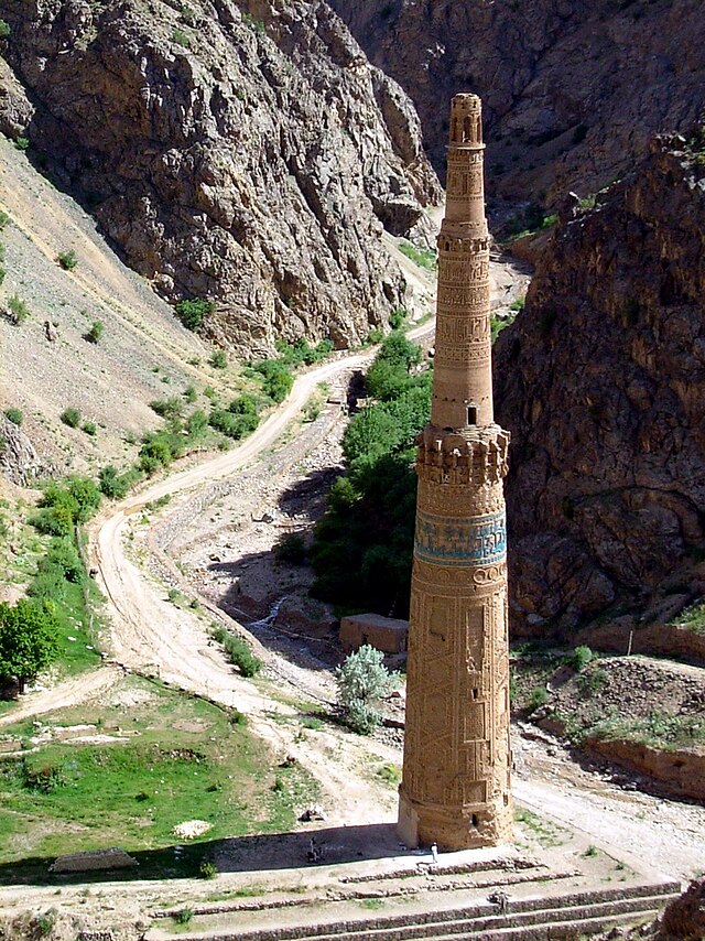
Historical background of Sur
In the ancient Vedic Arian language the word sura meant sun or figuratively, an enlightened and scholarly person. The roots of this word are seen in the Rig-Veda and Avesta. The ancient Arians regarded Suray as the Sun-god. Sur also meant a representation of a divinity or idol or sun,[1] which has firm roots in the ancient mythology and names of persons and places of India.
This same word has sometimes meant hero,[2] and in the form of sura has had a strong figurative meaning in Avesta.[3]
According to Christiesen when the Kasis occupied Babylon in the 18th century (B.C.), the worshippers of this same Surya in Avesta were the (Hvar) and after that in the 14th century (B.C.) in the writings of the Arian Mithanis, this divinity is Mitra-Mehr or Shums,[4] the Babylonian Ezid.
The worship of the sun and the images of Ezid i.e. God (Sur=Hur=Khur=Khir of which the "waw" is changed into a "ya" in one of the Pashto dialects) was also practiced since olden times among those of the Aryan race of Aryana and India, and they regarded its ray as the source of Khura (divine illumination) and heat and life. In the history of Afghanistan we have evidence that sun worship and sun-god statues were prevalent until the Kushan period and the introduction of Islam into this land (7th century). Because in the relics discovered at Surkh Kotal (7th century) and the marble idols of the present day Khair Khana pass (5th century) traces of this creed could be observed.[5] It could therefore be said that the real name of Khair Khana should be Khur Khana or Khurshed Khana (home of the sun), whence the remains of the Surya temple and two marble statutes of this deity were discovered, and the boundaries and foundations of its temple were unearthed as a result of archaeological diggings.[6]
Huen Tsang, the Chinese pilgrim, who in May 630 A.D. and then upon his return from India in June, 644 (24 A.H.) had visited Kabulistan mentions a temple 70 Ii (about 23 miles) to the south of Kapisa in which the heavenly spirit Suna[7] (i.e. the same deity Surya) was worshipped. But later he went to the Sunagir (Tsu-na-hilu) mountain which is located in the country of Tso-ku-cha, i.e. Zabulistan, and people were worshipping and bestowing gold, silver, and enormous offerings to it.[8]
It seems that the Nepthalites of the 5th century also worshipped the ancient sun-god and destroyed Buddhist temples. The bust of this deity is engraved on some of their coins with flames bursting out from the back of its head. Jonker also shows coins of this type on which the names of Dawar-Zabal can be observed,[9] which proves the prevalence of this faith in this land as in the time of the first and second century Kushans also one of the deities engraved on their coins was this same Surya (sun).[10]
The name of one of the victorious kings of the Hepthalites inscribed on the tablet discovered at Dara-i-Shali of Uruzgan to the north of Kandahar was Mer Kula=Mehr Kul=Mir Gul, i.e. from the Mehr family, which signifies the connection of the 5th and 6th century Hephtalite kings and their remnants till the beginning of the Islamic era with the faith of sun worship and the Surya deity.
During the period when Huen Tsang talks about the temples and the faith of Sura worship in Kabulistan and Zabul, we read in the Arabian and Islamic histories what Ahmad bin Yahya Bilzury (died 275 H/892 A.D.) writes in the chapter of Islamic conquests in Siestan and Kabul:
In the year 30 H./650 A.D., Rabe bin Ziad Harithi, the Arab governor, came to Siestan and two and a half years later Abdur Rahman bin Samara was appointed governor of Zaranj. He took the regions of Rokhaj and Dawar, besieged the people of Dawar in the Zur mountain, and confiscated the idol of Zur which was made of pure gold and had ruby eyes. He cut off its hands and took out the rubies, and giving them to the margrave he said, "my intention was to show you that this idol can do neither any harm nor good."[11]
Researchers had located this Surya temple in Zamindawar.[12] But when some time later I inquired from the people of Zamindawar (present-day Zindawar) about it, I found out that there exists, to this day, a village known as Deh-e Ar at a distance of three miles to the south of Musa Qala (capital of Zamindawar). In this village divided into the Zari Ulya and Zari Sufl[13] (upper and lower Zar) we can observe traces of the ruins of ancient buildings which are known among the local people by the name of Kafir Qala (fort of the infidel).
The Suris Of Ghor
As described in the foregoing pages the word Surya—the subsequent Sur and Suri has an ancient background in the history of religions of Afghanistan whose altered form in the western dialects of Khurasan is Zur and Zuri. The exchange of Sur to Nur (khurshed or sun) is also characteristic of the eastern and western dialects. For example, Suma-Numa, Sind-Hind, whose 's' has been changed into 'z' in western Khurasan, and hence we call the well-known Afghan Suri tribe, who migrated from the slopes of Kisey Ghar (Sulaiman Mountain) to the east and India, Suri (Indian Kings of the Suri race such as Sher Shah Suri, belonged to this tribe) while in the western part of Ghor and Herat and Badghis they are called Zuris. The name Zur also influenced the denomination of cities and tribes. For instance Zurabad was the name of a city which still exists by this name to the south of Sarakhs and the farthest north-western corners of the Afghan border in Herat province. Yaqut has considered it Zurabz from the regions of Sarakhs[14] and its relative is Zurabzi.[15] Abu Bakr Mohammad bin Atiq bin Mohammad Surabadi Herawi, author of "Tafseer-ul- Surabadi and a contemporary of Alp Arsalan (445-465 H./1062-1072 A.D.) came from this place.[16]
One of the persons related to the Suri tribe was Mahawi Suri, the margrave of Merv who had the last Sassanid King Yazdi Gurd, killed by a miller in 31 H./651 A.D., and according to Tabari, had an audience with Hazrat Ali (the fourth Caliph) and obtained a letter from him authorizing Suri to collect tributes and taxes.[17]
This Mahawi Suri was a powerful ruler and, according to Firdowsi, conquered the citics of Balkh, Herat, and Bukhara.
To his first born he gave Balkh and Hari
And sent his armies in every direction,
He gave the soldiers money to prosper
Then toward Bukhara they marched
The warriors of the brave army.
If this legendary narrative of Firdowsi is not entirely true, at least its main points such as Mahawi's relationship with the Suri tribe and his contention with Yazdi Gurd are in accord with the relations by other historians. For the letter that Hazat Ali (May Go be pease with him) had issued and bore the date of 36 H./656 A.D is itself recorded by Jabari.[18]
Shihab al-Din of Ghor
[1] Sanskrit-English Dictionary, p. 1234. Oxford 1964.
[2] Hindi-English Dictionary, p. 488, London, 1866.
[3] Daudpoor, Yashtha. Vol. 1, p. 265. Tehran, 1968.
[4] The worship of Mazda in ancient Iran, p.32. Tehran 1947.
[5] Rosenfield. The Royal Art of the Kushans, p. 192.
[6] Hacken. Relics of Khair Khana pass, translated, Kohzad, Kabul, 1936.
[7] Suna, which in Arabic has been changed into Zun (see Majame-ul-Buldan, 4/28 and Al-Muraba of Jawaliqi, p 166 was the same idol of the sun goddess which in the Indo-European languages had the root (su-en or sa-uen) and in the Anglo Saxon it was (sunne, in German (sonne) and was changed to sun. English (Webster’s New Dictionary 146, 1957). Hence (sunagir) in Pashto is (sughar) and the present day (chunghar) is also from the remnants of this denomination meaning (sun mountains). The Snarod (Seistan) or Sunabad (Toos) and Suna Khan or Suna Kheil (names of Afghan distinguished men) are also from this category.
[8] Si-yu-ki, 1st book on Kia-pi-shi, 12th books on Tsu-su-cha (Zabul).
[9] Kohzad, History of Afghanistan, Vol. 2, pa. 577.
[10] Rosenfield. The art of the Kushanid Period. 294.
[11] Bilazuri. Futuh-ul-Buldan, p. 486.
[12] Lee, Strange. Geography of the Eastern Caliphate. Urdu translation, p. 521. Hyderabad, 1930.
[13] Habibi, A.H. Afghanistan after Islam. P. 1054, Kabul 1978.
[14] Marajiat-ul-Ittlas, Vol. 1, p. 512, Cairo, 1978.
[15] Ibid.
[16] Haji Khalifa. Kashf-uz-Zunon, Vol. 1, p. 310.
[17] Futuh, 505. Tarekh-e Yaqubi, Vo,. 2, p. 184.
[18] Tarekh-ul-Ummame wal Mulook, Vol. 3, p. 557.
A description of Pashtuns in 13th century india of delhi sultanates.Balban and Afghans
Last edited:
PUNJABIMUNDANO1
Banned
bro, ask dr qaeer khan, he consider himself pathan so what is ur problem? if u r not a pathan its ok, every tribe is respectful.
Dr Qdeerr Khan does not consider him Pushtun or pathan He claimed Turkish ancestory in his book
PUNJABIMUNDANO1
Banned
http://en.wikipedia.org/wiki/Battle_of_Nowshera#Background
Battle of Noshera AFGHAN VS PUNJABIES........ PUNJABIES WON

Battle of Noshera AFGHAN VS PUNJABIES........ PUNJABIES WON
PUNJABIMUNDANO1
Banned
http://en.wikipedia.org/wiki/Battle_of_Attock
Battle of Attock
Afghan vs Punjabies......... Punjabies won
Battle of Attock
Afghan vs Punjabies......... Punjabies won
PUNJABIMUNDANO1
Banned
http://en.wikipedia.org/wiki/Battle_of_Shopian
Battle of Shopian
Afghan vs Punjabies........... Punjbies won
Battle of Shopian
Afghan vs Punjabies........... Punjbies won
Last edited:
PUNJABIMUNDANO1
Banned
http://en.wikipedia.org/wiki/Battle_of_Jamrud
Battle of Jamrud
Afghans vs Punjabies........Punjabies won
Battle of Jamrud
Afghans vs Punjabies........Punjabies won
perfect janwer
Councller (250+ posts)
Sicko ko maar maar ke musalman banaya ta pathano ne, apne kisi bezurg se poch lena,,,,,,,,,kheir lahore mey tu ajkal saare puraney hindu abaad hy koyi naam nahi mila tu apne aap ko punjabi kehne lagey.http://en.wikipedia.org/wiki/Battle_of_Shopian
Battle of Shopian
Afghan vs Punjabies........... Punjbies won


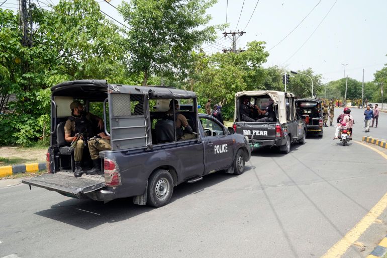
© Copyrights 2008 - 2025 Siasat.pk - All Rights Reserved. Privacy Policy | Disclaimer|
Official Siasat.pk Social Media Accounts


